Kihniö geodata
Kihniö (Pirkanmaa) is a seat of a third-order administrative division; located in Finland in Europe/Helsinki (GMT+3) time zone. With population of 2,305 people, there are 335 cities with bigger population in this country. Compared to other cities in Finland, 56.4% of cities are located further ↓South; 72.6% of cities are located further →East and 91.7% of cities have lower elevation than Kihniö. Note1


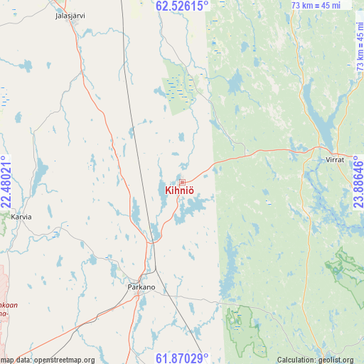
Kihniö GPS coordinates[2]
62° 12' 0" North, 23° 10' 59.988" East
| Map corner | latitude | longitude |
|---|---|---|
| Upper-left | 62.52615°, | 22.48021° |
| Center: | 62.2°, | 23.18333° |
| Lower-right: | 61.87029°, | 23.88646° |
| Map W x H: | 72.9×72.9 km | = 45.3×45.3mi |
| max Lat: | 69.90864° ⇑43.6% North |
| Kihniö: | 62.2° |
| min Lat: | ⇓56.4% South 59.83333° |
| min Long | Kihniö | max Long |
| 21.2° | 23.18333° | 30.93276° |
| W 27.4%⇐ | ⇒72.6% E |
Elevation
Elevation of Kihniö is 145 m = 476 ft, and this is 67.9 m = 223 ft above average elevation for this country.
| Max E: |
299 m = 981 ft | 8.3% |
| Kihniö | 145 m 476 ft | |
| Avg. | 77.1 m = 253 ft | |
Min E: |
1 m = 3 ft | 91.7% |
See also: Finland elevation on elevation.city.
Geographical zone
Kihniö is located in North temperate zone (between Tropic of Cancer and the Arctic Circle). Distance of this North polar circle is 485.2 km =301.5 mi to North.| Distance of | km | miles | from Kihniö |
|---|---|---|---|
| North Pole | 3091.1 | 1920.7 | to North |
| Arctic Circle | 485.2 | 301.5 | to North |
| Tropic Cancer | 4310.1 | 2678.2 | to South |
| Equator | 6916 | 4297.4 | to South |


Nearby cities:
15 places around Kihniö: (largest is in red/bold)
• Alavus
48.1 km =29.9 mi,  27°
27°
• Honkajoki
53.4 km =33.2 mi,  243°
243°
• Ikaalinen
48.3 km =30 mi,  187°
187°
• Jalasjärvi
40.2 km =25 mi,  326°
326°
• Jämijärvi
49.5 km =30.8 mi,  210°
210°
• Kankaanpää
59.8 km =37.2 mi,  221°
221°
• Karvia
27.7 km =17.2 mi,  270°
270°
• Karvia
32.9 km =20.4 mi,  256°
256°
• Kauhajoki
57.8 km =35.9 mi,  296°
296°
• Kuru
45.6 km =28.3 mi,  142°
142°
• Parkano
22.2 km =13.8 mi,  203°
203°
• Ruovesi
51.3 km =31.9 mi,  117°
117°
• Töysä
57.7 km =35.9 mi, 34°
• Viljakkala
55.1 km =34.2 mi,  175°
175°
• Virrat
31.4 km =19.5 mi,  80°
80°
Sources, notices
• [Note1] Compared only with cities in Finland existing in our database
• [Src1] Map data: © OpenStreetMap contributors (CC-BY-SA)
• [Src2] Other city data from geonames.org with taken over terms of usage.
• [Src3] Geographical zone / Annual Mean Temperature by Robert A. Rohde @ Wikipedia
