Isokyrö geodata
Isokyrö (Ostrobothnia) is a seat of a third-order administrative division; located in Finland in Europe/Helsinki (GMT+3) time zone. With population of 5,040 people, there are 207 cities with bigger population in this country. Compared to other cities in Finland, 71.2% of cities are located further ↓South; 85.9% of cities are located further →East and 74.6% of cities have higher elevation than Isokyrö. Note1


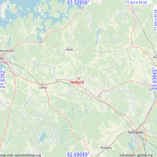
Isokyrö GPS coordinates[2]
63° 0' 42.192" North, 22° 19' 59.952" East
| Map corner | latitude | longitude |
|---|---|---|
| Upper-left | 63.32906°, | 21.6302° |
| Center: | 63.01172°, | 22.33332° |
| Lower-right: | 62.69089°, | 23.03645° |
| Map W x H: | 71×71 km | = 44.1×44.1mi |
| max Lat: | 69.90864° ⇑28.8% North |
| Isokyrö: | 63.01172° |
| min Lat: | ⇓71.2% South 59.83333° |
| min Long | Isokyrö | max Long |
| 21.2° | 22.33332° | 30.93276° |
| W 14.1%⇐ | ⇒85.9% E |
Elevation
Elevation of Isokyrö is 30 m = 98 ft, and this is 47.1 m = 155 ft below average elevation for this country.
| Max E: |
299 m = 981 ft | 74.6% |
| Avg. | 77.1 m = 253 ft | |
| Isokyrö | 30 m = 98 ft | |
Min E: |
1 m = 3 ft | 25.4% |
See also: Finland elevation on elevation.city.
Geographical zone
Isokyrö is located in North temperate zone (between Tropic of Cancer and the Arctic Circle). Distance of this North polar circle is 394.9 km =245.4 mi to North.| Distance of | km | miles | from Isokyrö |
|---|---|---|---|
| North Pole | 3000.8 | 1864.6 | to North |
| Arctic Circle | 394.9 | 245.4 | to North |
| Tropic Cancer | 4400.3 | 2734.2 | to South |
| Equator | 7006.2 | 4353.4 | to South |


Nearby cities:
15 places around Isokyrö: (largest is in red/bold)
• Alahärmä
35.8 km =22.2 mi,  46°
46°
• Ilmajoki
33.1 km =20.6 mi,  159°
159°
• Korsholm
34.7 km =21.6 mi,  289°
289°
• Laihia
16.7 km =10.4 mi,  256°
256°
• Lapua
34.4 km =21.4 mi,  97°
97°
• Nurmo
35.6 km =22.1 mi,  124°
124°
• Oravais
32.3 km =20.1 mi,  4°
4°
• Ristinummi
32 km =19.9 mi, 286°
• Seinäjoki
34.8 km =21.6 mi,  133°
133°
• Smedsby
34 km =21.1 mi, 290°
• Teeriniemi
33.5 km =20.8 mi, 286°
• Vähäkyrö
12.5 km =7.8 mi, 293°
• Vörå
14.4 km =8.9 mi,  343°
343°
• Ylihärmä
27.4 km =17 mi,  55°
55°
• Ylistaro
12.1 km =7.5 mi, 131°
Sources, notices
• [Note1] Compared only with cities in Finland existing in our database
• [Src1] Map data: © OpenStreetMap contributors (CC-BY-SA)
• [Src2] Other city data from geonames.org with taken over terms of usage.
• [Src3] Geographical zone / Annual Mean Temperature by Robert A. Rohde @ Wikipedia
