Ilmajoki geodata
Ilmajoki (Southern Ostrobothnia) is a seat of a third-order administrative division; located in Finland in Europe/Helsinki (GMT+3) time zone. With population of 11,693 people, there are 92 cities with bigger population in this country. Compared to other cities in Finland, 65.8% of cities are located further ↓South; 83.1% of cities are located further →East and 69.4% of cities have higher elevation than Ilmajoki. Note1


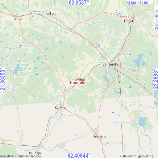
Ilmajoki GPS coordinates[2]
62° 43' 59.988" North, 22° 34' 0.012" East
| Map corner | latitude | longitude |
|---|---|---|
| Upper-left | 63.0537°, | 21.86355° |
| Center: | 62.73333°, | 22.56667° |
| Lower-right: | 62.40944°, | 23.2698° |
| Map W x H: | 71.6×71.6 km | = 44.5×44.5mi |
| max Lat: | 69.90864° ⇑34.2% North |
| Ilmajoki: | 62.73333° |
| min Lat: | ⇓65.8% South 59.83333° |
| min Long | Ilmajoki | max Long |
| 21.2° | 22.56667° | 30.93276° |
| W 16.9%⇐ | ⇒83.1% E |
Elevation
Elevation of Ilmajoki is 41 m = 135 ft, and this is 36.1 m = 118 ft below average elevation for this country.
| Max E: |
299 m = 981 ft | 69.4% |
| Avg. | 77.1 m = 253 ft | |
| Ilmajoki | 41 m = 135 ft | |
Min E: |
1 m = 3 ft | 30.6% |
See also: Finland elevation on elevation.city.
Geographical zone
Ilmajoki is located in North temperate zone (between Tropic of Cancer and the Arctic Circle). Distance of this North polar circle is 425.9 km =264.6 mi to North.| Distance of | km | miles | from Ilmajoki |
|---|---|---|---|
| North Pole | 3031.8 | 1883.9 | to North |
| Arctic Circle | 425.9 | 264.6 | to North |
| Tropic Cancer | 4369.4 | 2715 | to South |
| Equator | 6975.3 | 4334.2 | to South |


Nearby cities:
15 places around Ilmajoki: (largest is in red/bold)
• Isokyrö
33.1 km =20.6 mi,  339°
339°
• Jalasjärvi
27.6 km =17.1 mi,  160°
160°
• Jurva
30.3 km =18.8 mi,  259°
259°
• Kauhajoki
38.7 km =24 mi,  210°
210°
• Kauhava
48.4 km =30.1 mi,  31°
31°
• Kuortane
48.1 km =29.9 mi,  81°
81°
• Kurikka
15.1 km =9.4 mi, 210°
• Laihia
39 km =24.2 mi,  313°
313°
• Lapua
34.5 km =21.4 mi,  40°
40°
• Nurmo
20.4 km =12.7 mi,  58°
58°
• Seinäjoki
14.9 km =9.3 mi, 62°
• Vähäkyrö
42.8 km =26.6 mi,  326°
326°
• Vörå
47.5 km =29.5 mi, 340°
• Ylihärmä
47.6 km =29.6 mi,  13°
13°
• Ylistaro
23.1 km =14.4 mi,  353°
353°
Sources, notices
• [Note1] Compared only with cities in Finland existing in our database
• [Src1] Map data: © OpenStreetMap contributors (CC-BY-SA)
• [Src2] Other city data from geonames.org with taken over terms of usage.
• [Src3] Geographical zone / Annual Mean Temperature by Robert A. Rohde @ Wikipedia
