Cities geodata
In our database we have geo data for 31 cities located in Faroe Islands including Torshavn as capital of the country. Places are located on North hemisphere, between 61.47324° and 62.35999° latitude.
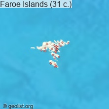
Geo statistics for cities in Faroe Islands:
| . | Min | Avg. | Max. |
| Latitude | 61.47324° | 61.99733° | 62.35999° |
| Longitude | -7.30749° | -6.81982° | -6.32379° |
| Elevation | 1m=3ft | 88.4m=290ft | 358m=1175ft |
Faroe Islands has no neighboring country
List of cities in ABC order:
Search by letter:
Sources
- Map data: © OpenStreetMap contributors (CC-BY-SA)
- [1] Calculated only from 31 cities in our database
- Other city data from geonames.org with taken over terms of usage.
