Vouziers geodata
Vouziers (Grand Est) is a seat of a third-order administrative division; located in France in Europe/Paris (GMT+2) time zone. With population of 4,946 people, there are 2001 cities with bigger population in this country. Compared to other cities in France, 87.9% of cities are located further ↓South; 73.7% of cities are located further ←West and 62.8% of cities have higher elevation than Vouziers. Note1
Administrative division(s):
- Level 1: Grand Est
- Level 2: Ardennes
- Level 3: Arrondissement de Vouziers
- Level 4: Vouziers


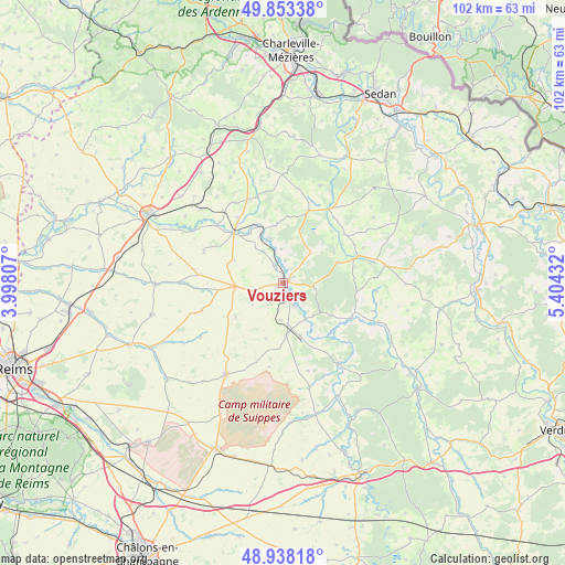
Vouziers GPS coordinates[2]
49° 23' 52.476" North, 4° 42' 4.32" East
| Map corner | latitude | longitude |
|---|---|---|
| Upper-left | 49.85338°, | 3.99807° |
| Center: | 49.39791°, | 4.7012° |
| Lower-right: | 48.93818°, | 5.40432° |
| Map W x H: | 101.8×101.8 km | = 63.3×63.3mi |
| max Lat: | 51.07786° ⇑12.1% North |
| Vouziers: | 49.39791° |
| min Lat: | ⇓87.9% South 41.3874° |
| min Long | Vouziers | max Long |
| -5.08615° | 4.7012° | 9.52242° |
| W 73.7%⇐ | ⇒26.3% E |
Elevation
Elevation of Vouziers is 95 m = 312 ft, and this is 98.7 m = 324 ft below average elevation for this country.
| Max E: |
2333 m = 7654 ft | 62.8% |
| Avg. | 193.7 m = 635 ft | |
| Vouziers | 95 m = 312 ft | |
Min E: |
-1 m = -3 ft | 37.2% |
See also: France elevation on elevation.city.
Geographical zone
Vouziers is located in North temperate zone (between Tropic of Cancer and the Arctic Circle). Distance of this North polar circle is 1908.6 km =1185.9 mi to North.| Distance of | km | miles | from Vouziers |
|---|---|---|---|
| North Pole | 4514.5 | 2805.2 | to North |
| Arctic Circle | 1908.6 | 1185.9 | to North |
| Tropic Cancer | 2886.6 | 1793.6 | to South |
| Equator | 5492.5 | 3412.9 | to South |


Nearby cities:
15 places around Vouziers: (largest is in red/bold)
• Acy-Romance
28.4 km =17.6 mi,  293°
293°
• Amagne
19.5 km =12.1 mi,  312°
312°
• Attigny
12.6 km =7.8 mi,  315°
315°
• Bétheniville
26.8 km =16.7 mi,  243°
243°
• Grandpré
13.8 km =8.6 mi,  117°
117°
• Juniville
23 km =14.3 mi,  269°
269°
• Le Chesne
13.6 km =8.5 mi,  19°
19°
• Lucquy
22 km =13.7 mi, 313°
• Novy-Chevrières
24.3 km =15.1 mi, 310°
• Poix-Terron
28.4 km =17.6 mi,  351°
351°
• Rethel
27.1 km =16.8 mi,  297°
297°
• Saulces-Monclin
24.7 km =15.3 mi, 323°
• Sault-lès-Rethel
27 km =16.8 mi, 294°
• Sommepy-Tahure
19.3 km =12 mi,  212°
212°
• Vienne-le-Château
26.7 km =16.6 mi,  149°
149°
Sources, notices
• [Note1] Compared only with cities in France existing in our database
• [Src1] Map data: © OpenStreetMap contributors (CC-BY-SA)
• [Src2] Other city data from geonames.org with taken over terms of usage.
• [Src3] Geographical zone / Annual Mean Temperature by Robert A. Rohde @ Wikipedia
