Grandpré geodata
Grandpré (Grand Est) is a populated place; located in France in Europe/Paris (GMT+2) time zone. With population of 526 people, there are 14691 cities with bigger population in this country. Compared to other cities in France, 86.8% of cities are located further ↓South; 76.1% of cities are located further ←West and 53.8% of cities have higher elevation than Grandpré. Note1
Administrative division(s):
- Level 1: Grand Est
- Level 2: Ardennes
- Level 3: Arrondissement de Vouziers
- Level 4: Grandpré


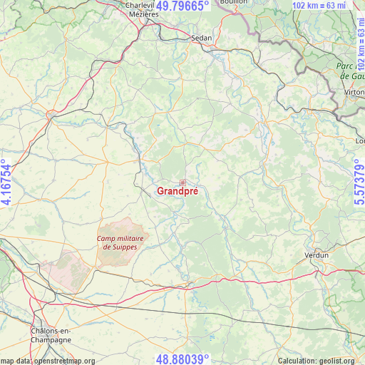
Grandpré GPS coordinates[2]
49° 20' 26.34" North, 4° 52' 14.412" East
| Map corner | latitude | longitude |
|---|---|---|
| Upper-left | 49.79665°, | 4.16754° |
| Center: | 49.34065°, | 4.87067° |
| Lower-right: | 48.88039°, | 5.57379° |
| Map W x H: | 101.9×101.9 km | = 63.3×63.3mi |
| max Lat: | 51.07786° ⇑13.2% North |
| Grandpré: | 49.34065° |
| min Lat: | ⇓86.8% South 41.3874° |
| min Long | Grandpré | max Long |
| -5.08615° | 4.87067° | 9.52242° |
| W 76.1%⇐ | ⇒23.9% E |
Elevation
Elevation of Grandpré is 120 m = 394 ft, and this is 73.7 m = 242 ft below average elevation for this country.
| Max E: |
2333 m = 7654 ft | 53.8% |
| Avg. | 193.7 m = 635 ft | |
| Grandpré | 120 m = 394 ft | |
Min E: |
-1 m = -3 ft | 46.2% |
See also: France elevation on elevation.city.
Geographical zone
Grandpré is located in North temperate zone (between Tropic of Cancer and the Arctic Circle). Distance of this North polar circle is 1915 km =1189.9 mi to North.| Distance of | km | miles | from Grandpré |
|---|---|---|---|
| North Pole | 4520.9 | 2809.2 | to North |
| Arctic Circle | 1915 | 1189.9 | to North |
| Tropic Cancer | 2880.2 | 1789.7 | to South |
| Equator | 5486.2 | 3409 | to South |


Nearby cities:
15 places around Grandpré: (largest is in red/bold)
• Attigny
26.1 km =16.2 mi,  305°
305°
• Clermont-en-Argonne
29.7 km =18.5 mi,  150°
150°
• Dun-sur-Meuse
23.3 km =14.5 mi,  78°
78°
• Haraucourt
32.1 km =19.9 mi,  11°
11°
• Le Chesne
20.7 km =12.9 mi,  338°
338°
• Les Islettes
27.5 km =17.1 mi,  159°
159°
• Mouzay
28.6 km =17.8 mi,  61°
61°
• Raucourt-et-Flaba
29.9 km =18.6 mi, 12°
• Sainte-Menehould
27.9 km =17.3 mi,  176°
176°
• Somme-Suippe
32.7 km =20.3 mi,  220°
220°
• Sommepy-Tahure
24.7 km =15.3 mi,  246°
246°
• Stenay
28.5 km =17.7 mi,  53°
53°
• Varennes-en-Argonne
17.3 km =10.7 mi,  136°
136°
• Vienne-le-Château
16.7 km =10.4 mi, 175°
• Vouziers
13.8 km =8.6 mi,  297°
297°
Sources, notices
• [Note1] Compared only with cities in France existing in our database
• [Src1] Map data: © OpenStreetMap contributors (CC-BY-SA)
• [Src2] Other city data from geonames.org with taken over terms of usage.
• [Src3] Geographical zone / Annual Mean Temperature by Robert A. Rohde @ Wikipedia
