Viry geodata
Viry (Bourgogne-Franche-Comté) is a populated place; located in France in Europe/Paris (GMT+2) time zone. With population of 851 people, there are 10072 cities with bigger population in this country. Compared to other cities in France, 62.3% of cities are located further ↑North; 84.6% of cities are located further ←West and 97.5% of cities have lower elevation than Viry. Note1
Administrative division(s):
- Level 1: Bourgogne-Franche-Comté
- Level 2: Jura
- Level 3: Arrondissement de Saint-Claude
- Level 4: Viry


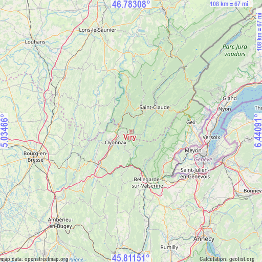
Viry GPS coordinates[2]
46° 17' 58.02" North, 5° 44' 16.008" East
| Map corner | latitude | longitude |
|---|---|---|
| Upper-left | 46.78308°, | 5.03466° |
| Center: | 46.29945°, | 5.73778° |
| Lower-right: | 45.81151°, | 6.44091° |
| Map W x H: | 108×108 km | = 67.1×67.1mi |
| max Lat: | 51.07786° ⇑62.3% North |
| Viry: | 46.29945° |
| min Lat: | ⇓37.7% South 41.3874° |
| min Long | Viry | max Long |
| -5.08615° | 5.73778° | 9.52242° |
| W 84.6%⇐ | ⇒15.4% E |
Elevation
Elevation of Viry is 769 m = 2523 ft, and this is 575.3 m = 1887 ft above average elevation for this country.
| Max E: |
2333 m = 7654 ft | 2.5% |
| Viry | 769 m 2523 ft | |
| Avg. | 193.7 m = 635 ft | |
Min E: |
-1 m = -3 ft | 97.5% |
See also: France elevation on elevation.city.
Geographical zone
Viry is located in North temperate zone (between Tropic of Cancer and the Arctic Circle). Distance of this North polar circle is 2253.2 km =1400.1 mi to North.| Distance of | km | miles | from Viry |
|---|---|---|---|
| North Pole | 4859 | 3019.2 | to North |
| Arctic Circle | 2253.2 | 1400.1 | to North |
| Tropic Cancer | 2542.1 | 1579.6 | to South |
| Equator | 5148 | 3198.8 | to South |


Nearby cities:
15 places around Viry: (largest is in red/bold)
• Arbent
4.6 km =2.9 mi,  259°
259°
• Bellignat
10.5 km =6.5 mi,  232°
232°
• Champfromier
13.1 km =8.1 mi,  153°
153°
• Chassal
7.3 km =4.5 mi,  28°
28°
• Dortan
6.4 km =4 mi,  290°
290°
• Groissiat
13.2 km =8.2 mi, 229°
• Géovreisset
10.3 km =6.4 mi,  242°
242°
• Lavans-lès-Saint-Claude
10.1 km =6.3 mi,  19°
19°
• Molinges
6.6 km =4.1 mi, 18°
• Oyonnax
7.6 km =4.7 mi, 234°
• Pratz
8.9 km =5.5 mi,  12°
12°
• Saint-Germain-de-Joux
13.4 km =8.3 mi,  179°
179°
• Saint-Lupicin
12 km =7.5 mi, 20°
• Vaux-lès-Saint-Claude
6.5 km =4 mi,  359°
359°
• Villard-Saint-Sauveur
11.7 km =7.3 mi,  54°
54°
Sources, notices
• [Note1] Compared only with cities in France existing in our database
• [Src1] Map data: © OpenStreetMap contributors (CC-BY-SA)
• [Src2] Other city data from geonames.org with taken over terms of usage.
• [Src3] Geographical zone / Annual Mean Temperature by Robert A. Rohde @ Wikipedia
