Saint-Germain-de-Joux geodata
Saint-Germain-de-Joux (Auvergne-Rhône-Alpes) is a populated place; located in France in Europe/Paris (GMT+2) time zone. With population of 528 people, there are 14653 cities with bigger population in this country. Compared to other cities in France, 63.9% of cities are located further ↑North; 84.6% of cities are located further ←West and 93.2% of cities have lower elevation than Saint-Germain-de-Joux. Note1
Administrative division(s):
- Level 1: Auvergne-Rhône-Alpes
- Level 2: Département de l'Ain
- Level 3: Arrondissement de Nantua
- Level 4: Saint-Germain-de-Joux
Current local time in Saint-Germain-de-Joux:
01:00 PM, SaturdayDifference from your time zone: hours


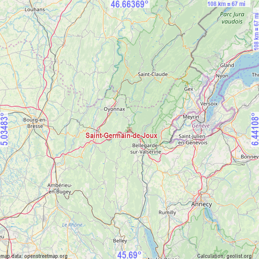
Saint-Germain-de-Joux GPS coordinates[2]
46° 10' 44.4" North, 5° 44' 16.62" East
| Map corner | latitude | longitude |
|---|---|---|
| Upper-left | 46.66369°, | 5.03483° |
| Center: | 46.179°, | 5.73795° |
| Lower-right: | 45.69°, | 6.44108° |
| Map W x H: | 108.3×108.3 km | = 67.3×67.3mi |
| max Lat: | 51.07786° ⇑63.9% North |
| Saint-Germain-de-Joux: | 46.179° |
| min Lat: | ⇓36.1% South 41.3874° |
| min Long | Saint-Germain-d | max Long |
| -5.08615° | 5.73795° | 9.52242° |
| W 84.6%⇐ | ⇒15.4% E |
Elevation
Elevation of Saint-Germain-de-Joux is 511 m = 1677 ft, and this is 317.3 m = 1041 ft above average elevation for this country.
| Max E: |
2333 m = 7654 ft | 6.8% |
| Saint-Germain-de-Joux | 511 m 1677 ft | |
| Avg. | 193.7 m = 635 ft | |
Min E: |
-1 m = -3 ft | 93.2% |
See also: France elevation on elevation.city.
Geographical zone
Saint-Germain-de-Joux is located in North temperate zone (between Tropic of Cancer and the Arctic Circle). Distance of this North polar circle is 2266.6 km =1408.4 mi to North.| Distance of | km | miles | from Saint-Germain-de-Joux |
|---|---|---|---|
| North Pole | 4872.4 | 3027.6 | to North |
| Arctic Circle | 2266.6 | 1408.4 | to North |
| Tropic Cancer | 2528.7 | 1571.3 | to South |
| Equator | 5134.6 | 3190.5 | to South |


Nearby cities:
15 places around Saint-Germain-de-Joux: (largest is in red/bold)
• Bellegarde-sur-Valserine
10.3 km =6.4 mi,  139°
139°
• Bellignat
11 km =6.8 mi,  309°
309°
• Champfromier
6.1 km =3.8 mi,  74°
74°
• Châtillon-en-Michaille
6.2 km =3.9 mi,  130°
130°
• Confort
7.3 km =4.5 mi,  115°
115°
• Farges
12.9 km =8 mi,  95°
95°
• Groissiat
11.1 km =6.9 mi,  295°
295°
• Géovreisset
12.6 km =7.8 mi, 313°
• Lancrans
9.3 km =5.8 mi, 128°
• Les Neyrolles
9.1 km =5.7 mi,  242°
242°
• Martignat
10.4 km =6.5 mi,  289°
289°
• Montréal-la-Cluse
11.9 km =7.4 mi,  272°
272°
• Nantua
10.6 km =6.6 mi,  254°
254°
• Oyonnax
10.9 km =6.8 mi,  325°
325°
• Port
13.2 km =8.2 mi,  262°
262°
Sources, notices
• [Note1] Compared only with cities in France existing in our database
• [Src1] Map data: © OpenStreetMap contributors (CC-BY-SA)
• [Src2] Other city data from geonames.org with taken over terms of usage.
• [Src3] Geographical zone / Annual Mean Temperature by Robert A. Rohde @ Wikipedia
