Vaux-lès-Saint-Claude geodata
Vaux-lès-Saint-Claude (Bourgogne-Franche-Comté) is a populated place; located in France in Europe/Paris (GMT+2) time zone. With population of 709 people, there are 11666 cities with bigger population in this country. Compared to other cities in France, 61.6% of cities are located further ↑North; 84.6% of cities are located further ←West and 84.2% of cities have lower elevation than Vaux-lès-Saint-Claude. Note1
Administrative division(s):
- Level 1: Bourgogne-Franche-Comté
- Level 2: Jura
- Level 3: Arrondissement de Saint-Claude
- Level 4: Vaux-lès-Saint-Claude
Current local time in Vaux-lès-Saint-Claude:
02:24 PM, SaturdayDifference from your time zone: hours


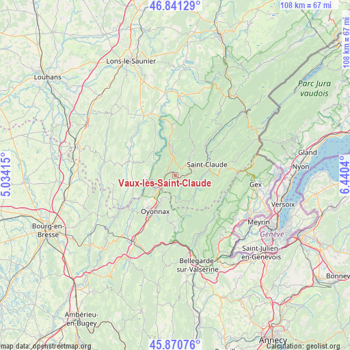
Vaux-lès-Saint-Claude GPS coordinates[2]
46° 21' 29.448" North, 5° 44' 14.172" East
| Map corner | latitude | longitude |
|---|---|---|
| Upper-left | 46.84129°, | 5.03415° |
| Center: | 46.35818°, | 5.73727° |
| Lower-right: | 45.87076°, | 6.4404° |
| Map W x H: | 107.9×107.9 km | = 67×67mi |
| max Lat: | 51.07786° ⇑61.6% North |
| Vaux-lès-Saint-Claude: | 46.35818° |
| min Lat: | ⇓38.4% South 41.3874° |
| min Long | Vaux-lès-Saint | max Long |
| -5.08615° | 5.73727° | 9.52242° |
| W 84.6%⇐ | ⇒15.4% E |
Elevation
Elevation of Vaux-lès-Saint-Claude is 337 m = 1106 ft, and this is 143.3 m = 470 ft above average elevation for this country.
| Max E: |
2333 m = 7654 ft | 15.8% |
| Vaux-lès-Saint-Claude | 337 m 1106 ft | |
| Avg. | 193.7 m = 635 ft | |
Min E: |
-1 m = -3 ft | 84.2% |
See also: France elevation on elevation.city.
Geographical zone
Vaux-lès-Saint-Claude is located in North temperate zone (between Tropic of Cancer and the Arctic Circle). Distance of this North polar circle is 2246.6 km =1396 mi to North.| Distance of | km | miles | from Vaux-lès-Saint-Claude |
|---|---|---|---|
| North Pole | 4852.5 | 3015.2 | to North |
| Arctic Circle | 2246.6 | 1396 | to North |
| Tropic Cancer | 2548.6 | 1583.6 | to South |
| Equator | 5154.5 | 3202.9 | to South |


Nearby cities:
15 places around Vaux-lès-Saint-Claude: (largest is in red/bold)
• Arbent
8.6 km =5.3 mi,  211°
211°
• Arinthod
13.7 km =8.5 mi,  286°
286°
• Chassal
3.6 km =2.2 mi,  91°
91°
• Dortan
7.3 km =4.5 mi,  234°
234°
• Lavans-lès-Saint-Claude
4.5 km =2.8 mi,  49°
49°
• Moirans-en-Montagne
8.5 km =5.3 mi,  354°
354°
• Molinges
2.2 km =1.4 mi,  98°
98°
• Oyonnax
12.6 km =7.8 mi, 209°
• Pratz
2.9 km =1.8 mi,  41°
41°
• Saint-Claude
10.3 km =6.4 mi,  71°
71°
• Saint-Lupicin
6.3 km =3.9 mi, 41°
• Septmoncel
13.6 km =8.5 mi,  83°
83°
• Valfin-lès-Saint-Claude
12.6 km =7.8 mi, 45°
• Villard-Saint-Sauveur
9.6 km =6 mi, 88°
• Viry
6.5 km =4 mi,  179°
179°
Sources, notices
• [Note1] Compared only with cities in France existing in our database
• [Src1] Map data: © OpenStreetMap contributors (CC-BY-SA)
• [Src2] Other city data from geonames.org with taken over terms of usage.
• [Src3] Geographical zone / Annual Mean Temperature by Robert A. Rohde @ Wikipedia
