Vireux-Wallerand geodata
Vireux-Wallerand (Grand Est) is a populated place; located in France in Europe/Paris (GMT+2) time zone. With population of 2,034 people, there are 4717 cities with bigger population in this country. Compared to other cities in France, 94.1% of cities are located further ↓South; 74.1% of cities are located further ←West and 50.5% of cities have higher elevation than Vireux-Wallerand. Note1
Administrative division(s):
- Level 1: Grand Est
- Level 2: Ardennes
- Level 3: Arrondissement de Charleville-Mézières
- Level 4: Vireux-Wallerand


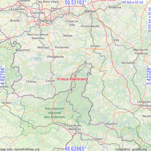
Vireux-Wallerand GPS coordinates[2]
50° 4' 55.056" North, 4° 43' 48.612" East
| Map corner | latitude | longitude |
|---|---|---|
| Upper-left | 50.53103°, | 4.02704° |
| Center: | 50.08196°, | 4.73017° |
| Lower-right: | 49.62865°, | 5.43329° |
| Map W x H: | 100.3×100.3 km | = 62.3×62.3mi |
| max Lat: | 51.07786° ⇑5.9% North |
| Vireux-Wallerand: | 50.08196° |
| min Lat: | ⇓94.1% South 41.3874° |
| min Long | Vireux-Walleran | max Long |
| -5.08615° | 4.73017° | 9.52242° |
| W 74.1%⇐ | ⇒25.9% E |
Elevation
Elevation of Vireux-Wallerand is 130 m = 427 ft, and this is 63.7 m = 209 ft below average elevation for this country.
| Max E: |
2333 m = 7654 ft | 50.5% |
| Avg. | 193.7 m = 635 ft | |
| Vireux-Wallerand | 130 m = 427 ft | |
Min E: |
-1 m = -3 ft | 49.5% |
See also: France elevation on elevation.city.
Geographical zone
Vireux-Wallerand is located in North temperate zone (between Tropic of Cancer and the Arctic Circle). Distance of this North polar circle is 1832.6 km =1138.7 mi to North.| Distance of | km | miles | from Vireux-Wallerand |
|---|---|---|---|
| North Pole | 4438.5 | 2758 | to North |
| Arctic Circle | 1832.6 | 1138.7 | to North |
| Tropic Cancer | 2962.7 | 1840.9 | to South |
| Equator | 5568.6 | 3460.2 | to South |


Nearby cities:
15 places around Vireux-Wallerand: (largest is in red/bold)
• Aubrives
3.3 km =2.1 mi,  45°
45°
• Chooz
6 km =3.7 mi,  67°
67°
• Deville
22.6 km =14 mi,  184°
184°
• Fromelennes
10.3 km =6.4 mi,  63°
63°
• Fumay
10.2 km =6.3 mi,  189°
189°
• Givet
9.2 km =5.7 mi, 47°
• Hargnies
8.2 km =5.1 mi,  148°
148°
• Haybes
8.8 km =5.5 mi, 191°
• Laifour
18.9 km =11.7 mi, 187°
• Les Mazures
22.9 km =14.2 mi,  198°
198°
• Monthermé
21.9 km =13.6 mi, 180°
• Rancennes
7.4 km =4.6 mi, 59°
• Revin
17.1 km =10.6 mi, 203°
• Rocroi
22.8 km =14.2 mi,  220°
220°
• Vireux-Molhain
0.6 km =0.4 mi,  229°
229°
Sources, notices
• [Note1] Compared only with cities in France existing in our database
• [Src1] Map data: © OpenStreetMap contributors (CC-BY-SA)
• [Src2] Other city data from geonames.org with taken over terms of usage.
• [Src3] Geographical zone / Annual Mean Temperature by Robert A. Rohde @ Wikipedia
