Villevieux geodata
Villevieux (Bourgogne-Franche-Comté) is a populated place; located in France in Europe/Paris (GMT+2) time zone. With population of 700 people, there are 11801 cities with bigger population in this country. Compared to other cities in France, 57.8% of cities are located further ↑North; 82.6% of cities are located further ←West and 66.6% of cities have lower elevation than Villevieux. Note1
Administrative division(s):
- Level 1: Bourgogne-Franche-Comté
- Level 2: Jura
- Level 3: Arrondissement de Lons-le-Saunier
- Level 4: Villevieux


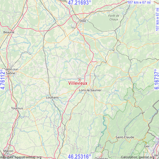
Villevieux GPS coordinates[2]
46° 44' 13.92" North, 5° 27' 51.3" East
| Map corner | latitude | longitude |
|---|---|---|
| Upper-left | 47.21693°, | 4.76112° |
| Center: | 46.7372°, | 5.46425° |
| Lower-right: | 46.25316°, | 6.16737° |
| Map W x H: | 107.2×107.2 km | = 66.6×66.6mi |
| max Lat: | 51.07786° ⇑57.8% North |
| Villevieux: | 46.7372° |
| min Lat: | ⇓42.2% South 41.3874° |
| min Long | Villevieux | max Long |
| -5.08615° | 5.46425° | 9.52242° |
| W 82.6%⇐ | ⇒17.4% E |
Elevation
Elevation of Villevieux is 202 m = 663 ft, and this is 8.3 m = 27 ft above average elevation for this country.
| Max E: |
2333 m = 7654 ft | 33.4% |
| Villevieux | 202 m 663 ft | |
| Avg. | 193.7 m = 635 ft | |
Min E: |
-1 m = -3 ft | 66.6% |
See also: France elevation on elevation.city.
Geographical zone
Villevieux is located in North temperate zone (between Tropic of Cancer and the Arctic Circle). Distance of this North polar circle is 2204.5 km =1369.8 mi to North.| Distance of | km | miles | from Villevieux |
|---|---|---|---|
| North Pole | 4810.4 | 2989 | to North |
| Arctic Circle | 2204.5 | 1369.8 | to North |
| Tropic Cancer | 2590.8 | 1609.8 | to South |
| Equator | 5196.7 | 3229.1 | to South |


Nearby cities:
15 places around Villevieux: (largest is in red/bold)
• Arlay
5.7 km =3.5 mi,  62°
62°
• Beaurepaire-en-Bresse
9.6 km =6 mi,  217°
217°
• Bletterans
1.3 km =0.8 mi,  324°
324°
• Chapelle-Voland
9.8 km =6.1 mi, 317°
• Commenailles
7.4 km =4.6 mi,  353°
353°
• Courlans
7.4 km =4.6 mi,  161°
161°
• Courlaoux
7.5 km =4.7 mi,  182°
182°
• Larnaud
3 km =1.9 mi,  194°
194°
• Lons-le-Saunier
9.8 km =6.1 mi,  134°
134°
• Messia-sur-Sorne
9.1 km =5.7 mi, 156°
• Montmorot
8.2 km =5.1 mi,  146°
146°
• Plainoiseau
7.1 km =4.4 mi,  93°
93°
• Ruffey-sur-Seille
2.5 km =1.6 mi,  71°
71°
• Saillenard
8.7 km =5.4 mi,  234°
234°
• Saint-Germain-lès-Arlay
7.7 km =4.8 mi, 71°
Sources, notices
• [Note1] Compared only with cities in France existing in our database
• [Src1] Map data: © OpenStreetMap contributors (CC-BY-SA)
• [Src2] Other city data from geonames.org with taken over terms of usage.
• [Src3] Geographical zone / Annual Mean Temperature by Robert A. Rohde @ Wikipedia
