Veyras geodata
Veyras (Auvergne-Rhône-Alpes) is a populated place; located in France in Europe/Paris (GMT+2) time zone. With population of 1,589 people, there are 5873 cities with bigger population in this country. Compared to other cities in France, 81.8% of cities are located further ↑North; 72.5% of cities are located further ←West and 90.5% of cities have lower elevation than Veyras. Note1
Administrative division(s):
- Level 1: Auvergne-Rhône-Alpes
- Level 2: Département de l'Ardèche
- Level 3: Arrondissement de Privas
- Level 4: Veyras


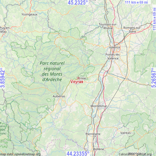
Veyras GPS coordinates[2]
44° 44' 6.648" North, 4° 33' 45.144" East
| Map corner | latitude | longitude |
|---|---|---|
| Upper-left | 45.2325°, | 3.85942° |
| Center: | 44.73518°, | 4.56254° |
| Lower-right: | 44.23355°, | 5.26567° |
| Map W x H: | 111.1×111.1 km | = 69×69mi |
| max Lat: | 51.07786° ⇑81.8% North |
| Veyras: | 44.73518° |
| min Lat: | ⇓18.2% South 41.3874° |
| min Long | Veyras | max Long |
| -5.08615° | 4.56254° | 9.52242° |
| W 72.5%⇐ | ⇒27.5% E |
Elevation
Elevation of Veyras is 438 m = 1437 ft, and this is 244.3 m = 802 ft above average elevation for this country.
| Max E: |
2333 m = 7654 ft | 9.5% |
| Veyras | 438 m 1437 ft | |
| Avg. | 193.7 m = 635 ft | |
Min E: |
-1 m = -3 ft | 90.5% |
See also: France elevation on elevation.city.
Geographical zone
Veyras is located in North temperate zone (between Tropic of Cancer and the Arctic Circle). Distance of this Northern Tropic circle is 2368.2 km =1471.5 mi to South.| Distance of | km | miles | from Veyras |
|---|---|---|---|
| North Pole | 5033 | 3127.4 | to North |
| Arctic Circle | 2427.1 | 1508.1 | to North |
| Tropic Cancer | 2368.2 | 1471.5 | to South |
| Equator | 4974.1 | 3090.8 | to South |


Nearby cities:
15 places around Veyras: (largest is in red/bold)
• Alissas
5.8 km =3.6 mi,  115°
115°
• Chomérac
8.4 km =5.2 mi,  111°
111°
• Coux
4.6 km =2.9 mi,  90°
90°
• Flaviac
8.9 km =5.5 mi,  80°
80°
• Les Ollières-sur-Eyrieux
8.7 km =5.4 mi,  27°
27°
• Lyas
3.8 km =2.4 mi,  49°
49°
• Privas
2.9 km =1.8 mi, 90°
• Saint-Fortunat-sur-Eyrieux
13.8 km =8.6 mi,  40°
40°
• Saint-Julien-en-Saint-Alban
10.8 km =6.7 mi, 78°
• Saint-Lager-Bressac
12.6 km =7.8 mi, 112°
• Saint-Pierreville
10.8 km =6.7 mi,  326°
326°
• Saint-Priest
2.4 km =1.5 mi,  211°
211°
• Saint-Sauveur-de-Montagut
9.7 km =6 mi,  8°
8°
• Saint-Symphorien-sous-Chomérac
11.3 km =7 mi,  98°
98°
• Vesseaux
13.4 km =8.3 mi,  226°
226°
Sources, notices
• [Note1] Compared only with cities in France existing in our database
• [Src1] Map data: © OpenStreetMap contributors (CC-BY-SA)
• [Src2] Other city data from geonames.org with taken over terms of usage.
• [Src3] Geographical zone / Annual Mean Temperature by Robert A. Rohde @ Wikipedia
