Saint-Julien-en-Saint-Alban geodata
Saint-Julien-en-Saint-Alban (Auvergne-Rhône-Alpes) is a populated place; located in France in Europe/Paris (GMT+2) time zone. With population of 1,078 people, there are 8272 cities with bigger population in this country. Compared to other cities in France, 81.7% of cities are located further ↑North; 73.7% of cities are located further ←West and 50.3% of cities have lower elevation than Saint-Julien-en-Saint-Alban. Note1
Administrative division(s):
- Level 1: Auvergne-Rhône-Alpes
- Level 2: Département de l'Ardèche
- Level 3: Arrondissement de Privas
- Level 4: Saint-Julien-en-Saint-Alban
Current local time in Saint-Julien-en-Saint-Alban:
02:17 PM, SaturdayDifference from your time zone: hours


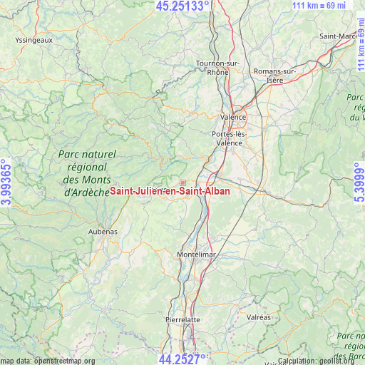
Saint-Julien-en-Saint-Alban GPS coordinates[2]
44° 45' 15.012" North, 4° 41' 48.408" East
| Map corner | latitude | longitude |
|---|---|---|
| Upper-left | 45.25133°, | 3.99365° |
| Center: | 44.75417°, | 4.69678° |
| Lower-right: | 44.2527°, | 5.3999° |
| Map W x H: | 111×111 km | = 69×69mi |
| max Lat: | 51.07786° ⇑81.7% North |
| Saint-Julien-en-Saint-Alban: | 44.75417° |
| min Lat: | ⇓18.3% South 41.3874° |
| min Long | Saint-Julien-en | max Long |
| -5.08615° | 4.69678° | 9.52242° |
| W 73.7%⇐ | ⇒26.3% E |
Elevation
Elevation of Saint-Julien-en-Saint-Alban is 133 m = 436 ft, and this is 60.7 m = 199 ft below average elevation for this country.
| Max E: |
2333 m = 7654 ft | 49.7% |
| Avg. | 193.7 m = 635 ft | |
| Saint-Julien-en-Saint-Alban | 133 m = 436 ft | |
Min E: |
-1 m = -3 ft | 50.3% |
See also: France elevation on elevation.city.
Geographical zone
Saint-Julien-en-Saint-Alban is located in North temperate zone (between Tropic of Cancer and the Arctic Circle). Distance of this Northern Tropic circle is 2370.3 km =1472.8 mi to South.| Distance of | km | miles | from Saint-Julien-en-Saint-Alban |
|---|---|---|---|
| North Pole | 5030.9 | 3126.1 | to North |
| Arctic Circle | 2425 | 1506.8 | to North |
| Tropic Cancer | 2370.3 | 1472.8 | to South |
| Equator | 4976.2 | 3092.1 | to South |


Nearby cities:
15 places around Saint-Julien-en-Saint-Alban: (largest is in red/bold)
• Alissas
7.1 km =4.4 mi,  228°
228°
• Baix
7.1 km =4.4 mi,  131°
131°
• Chomérac
5.9 km =3.7 mi,  208°
208°
• Coux
6.4 km =4 mi,  250°
250°
• Flaviac
1.9 km =1.2 mi, 248°
• La Voulte-sur-Rhône
8.2 km =5.1 mi,  52°
52°
• Le Pouzin
4.1 km =2.5 mi,  93°
93°
• Les Ollières-sur-Eyrieux
8.6 km =5.3 mi,  310°
310°
• Lyas
7.7 km =4.8 mi,  272°
272°
• Privas
8 km =5 mi, 254°
• Rompon
3.6 km =2.2 mi, 50°
• Saint-Fortunat-sur-Eyrieux
8.6 km =5.3 mi,  349°
349°
• Saint-Lager-Bressac
7 km =4.3 mi,  171°
171°
• Saint-Laurent-du-Pape
9.5 km =5.9 mi,  35°
35°
• Saint-Symphorien-sous-Chomérac
3.9 km =2.4 mi, 171°
Sources, notices
• [Note1] Compared only with cities in France existing in our database
• [Src1] Map data: © OpenStreetMap contributors (CC-BY-SA)
• [Src2] Other city data from geonames.org with taken over terms of usage.
• [Src3] Geographical zone / Annual Mean Temperature by Robert A. Rohde @ Wikipedia
