Saint-Fortunat-sur-Eyrieux geodata
Saint-Fortunat-sur-Eyrieux (Auvergne-Rhône-Alpes) is a populated place; located in France in Europe/Paris (GMT+2) time zone. With population of 567 people, there are 13878 cities with bigger population in this country. Compared to other cities in France, 81.2% of cities are located further ↑North; 73.5% of cities are located further ←West and 57.1% of cities have lower elevation than Saint-Fortunat-sur-Eyrieux. Note1
Administrative division(s):
- Level 1: Auvergne-Rhône-Alpes
- Level 2: Département de l'Ardèche
- Level 3: Arrondissement de Privas
- Level 4: Saint-Fortunat-sur-Eyrieux
Current local time in Saint-Fortunat-sur-Eyrieux:
02:59 PM, MondayDifference from your time zone: hours


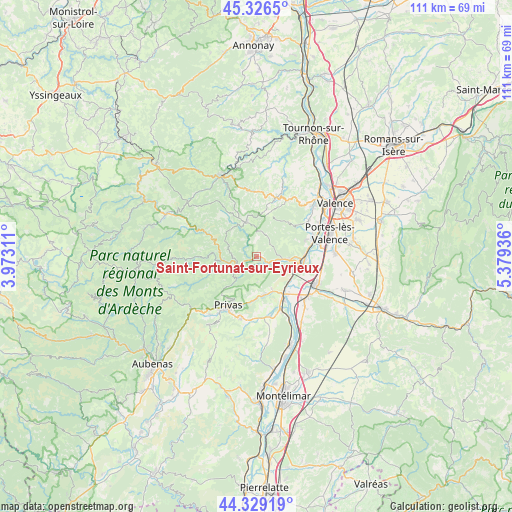
Saint-Fortunat-sur-Eyrieux GPS coordinates[2]
44° 49' 48" North, 4° 40' 34.428" East
| Map corner | latitude | longitude |
|---|---|---|
| Upper-left | 45.3265°, | 3.97311° |
| Center: | 44.83°, | 4.67623° |
| Lower-right: | 44.32919°, | 5.37936° |
| Map W x H: | 110.9×110.9 km | = 68.9×68.9mi |
| max Lat: | 51.07786° ⇑81.2% North |
| Saint-Fortunat-sur-Eyrieux: | 44.83° |
| min Lat: | ⇓18.8% South 41.3874° |
| min Long | Saint-Fortunat- | max Long |
| -5.08615° | 4.67623° | 9.52242° |
| W 73.5%⇐ | ⇒26.5% E |
Elevation
Elevation of Saint-Fortunat-sur-Eyrieux is 158 m = 518 ft, and this is 35.7 m = 117 ft below average elevation for this country.
| Max E: |
2333 m = 7654 ft | 42.9% |
| Avg. | 193.7 m = 635 ft | |
| Saint-Fortunat-sur-Eyrieux | 158 m = 518 ft | |
Min E: |
-1 m = -3 ft | 57.1% |
See also: France elevation on elevation.city.
Geographical zone
Saint-Fortunat-sur-Eyrieux is located in North temperate zone (between Tropic of Cancer and the Arctic Circle). Distance of this Northern Tropic circle is 2378.7 km =1478.1 mi to South.| Distance of | km | miles | from Saint-Fortunat-sur-Eyrieux |
|---|---|---|---|
| North Pole | 5022.4 | 3120.8 | to North |
| Arctic Circle | 2416.5 | 1501.5 | to North |
| Tropic Cancer | 2378.7 | 1478.1 | to South |
| Equator | 4984.6 | 3097.3 | to South |


Nearby cities:
15 places around Saint-Fortunat-sur-Eyrieux: (largest is in red/bold)
• Beauchastel
10 km =6.2 mi,  92°
92°
• Boffres
10.3 km =6.4 mi,  11°
11°
• Coux
11.5 km =7.1 mi,  202°
202°
• Flaviac
9.1 km =5.7 mi,  180°
180°
• La Voulte-sur-Rhône
8.8 km =5.5 mi,  112°
112°
• Le Pouzin
10.4 km =6.5 mi,  146°
146°
• Les Ollières-sur-Eyrieux
5.7 km =3.5 mi,  239°
239°
• Lyas
10.1 km =6.3 mi,  217°
217°
• Privas
12.2 km =7.6 mi,  209°
209°
• Rompon
7.6 km =4.7 mi,  144°
144°
• Saint-Georges-les-Bains
11 km =6.8 mi,  71°
71°
• Saint-Julien-en-Saint-Alban
8.6 km =5.3 mi,  169°
169°
• Saint-Laurent-du-Pape
7.2 km =4.5 mi,  95°
95°
• Saint-Sauveur-de-Montagut
7.7 km =4.8 mi,  262°
262°
• Vernoux-en-Vivarais
7.7 km =4.8 mi,  341°
341°
Sources, notices
• [Note1] Compared only with cities in France existing in our database
• [Src1] Map data: © OpenStreetMap contributors (CC-BY-SA)
• [Src2] Other city data from geonames.org with taken over terms of usage.
• [Src3] Geographical zone / Annual Mean Temperature by Robert A. Rohde @ Wikipedia
