Vernet-la-Varenne geodata
Vernet-la-Varenne (Auvergne-Rhône-Alpes) is a populated place; located in France in Europe/Paris (GMT+2) time zone. With population of 749 people, there are 11176 cities with bigger population in this country. Compared to other cities in France, 74.4% of cities are located further ↑North; 63.8% of cities are located further ←West and 98% of cities have lower elevation than Vernet-la-Varenne. Note1
Administrative division(s):
- Level 1: Auvergne-Rhône-Alpes
- Level 2: Département du Puy-de-Dôme
- Level 3: Issoire
- Level 4: Le Vernet-Chaméane


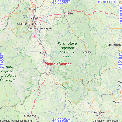
Vernet-la-Varenne GPS coordinates[2]
45° 28' 29.136" North, 3° 27' 6.156" East
| Map corner | latitude | longitude |
|---|---|---|
| Upper-left | 45.96565°, | 2.74858° |
| Center: | 45.47476°, | 3.45171° |
| Lower-right: | 44.97956°, | 4.15483° |
| Map W x H: | 109.6×109.6 km | = 68.1×68.1mi |
| max Lat: | 51.07786° ⇑74.4% North |
| Vernet-la-Varenne: | 45.47476° |
| min Lat: | ⇓25.6% South 41.3874° |
| min Long | Vernet-la-Varen | max Long |
| -5.08615° | 3.45171° | 9.52242° |
| W 63.8%⇐ | ⇒36.2% E |
Elevation
Elevation of Vernet-la-Varenne is 818 m = 2684 ft, and this is 624.3 m = 2048 ft above average elevation for this country.
| Max E: |
2333 m = 7654 ft | 2% |
| Vernet-la-Varenne | 818 m 2684 ft | |
| Avg. | 193.7 m = 635 ft | |
Min E: |
-1 m = -3 ft | 98% |
See also: France elevation on elevation.city.
Geographical zone
Vernet-la-Varenne is located in North temperate zone (between Tropic of Cancer and the Arctic Circle). Distance of this North polar circle is 2344.9 km =1457.1 mi to North.| Distance of | km | miles | from Vernet-la-Varenne |
|---|---|---|---|
| North Pole | 4950.7 | 3076.2 | to North |
| Arctic Circle | 2344.9 | 1457.1 | to North |
| Tropic Cancer | 2450.4 | 1522.6 | to South |
| Equator | 5056.3 | 3141.8 | to South |


Nearby cities:
15 places around Vernet-la-Varenne: (largest is in red/bold)
• Auzat-la-Combelle
10.7 km =6.6 mi,  256°
256°
• Auzon
11 km =6.8 mi,  213°
213°
• Brassac-les-Mines
11.7 km =7.3 mi,  234°
234°
• Charbonnier-les-Mines
14.5 km =9 mi,  243°
243°
• Fournols
11.7 km =7.3 mi,  66°
66°
• Jumeaux
10 km =6.2 mi, 240°
• Lamontgie
9.2 km =5.7 mi,  269°
269°
• Le Breuil-sur-Couze
14.7 km =9.1 mi, 267°
• Montaigut
15.6 km =9.7 mi,  359°
359°
• Parentignat
14.1 km =8.8 mi,  297°
297°
• Saint-Germain-l’Herm
7.2 km =4.5 mi,  104°
104°
• Sainte-Florine
13 km =8.1 mi, 233°
• Sauxillanges
10.5 km =6.5 mi,  323°
323°
• Sugères
14.5 km =9 mi,  346°
346°
• Vergongheon
15.5 km =9.6 mi,  221°
221°
Sources, notices
• [Note1] Compared only with cities in France existing in our database
• [Src1] Map data: © OpenStreetMap contributors (CC-BY-SA)
• [Src2] Other city data from geonames.org with taken over terms of usage.
• [Src3] Geographical zone / Annual Mean Temperature by Robert A. Rohde @ Wikipedia
