Vergèze geodata
Vergèze (Occitanie) is a populated place; located in France in Europe/Paris (GMT+2) time zone. With population of 3,955 people, there are 2490 cities with bigger population in this country. Compared to other cities in France, 89.8% of cities are located further ↑North; 69.9% of cities are located further ←West and 86.7% of cities have higher elevation than Vergèze. Note1
Administrative division(s):
- Level 1: Occitanie
- Level 2: Gard
- Level 3: Arrondissement de Nîmes
- Level 4: Vergèze


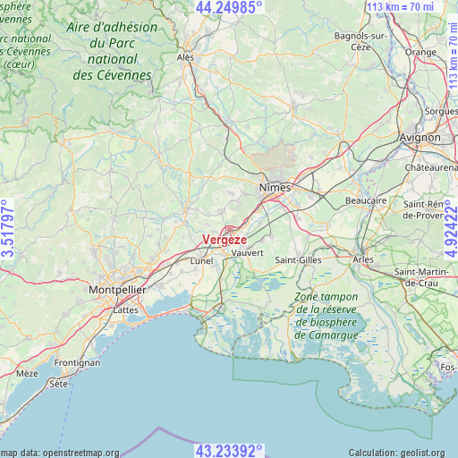
Vergèze GPS coordinates[2]
43° 44' 38.544" North, 4° 13' 15.924" East
| Map corner | latitude | longitude |
|---|---|---|
| Upper-left | 44.24985°, | 3.51797° |
| Center: | 43.74404°, | 4.22109° |
| Lower-right: | 43.23392°, | 4.92422° |
| Map W x H: | 113×113 km | = 70.2×70.2mi |
| max Lat: | 51.07786° ⇑89.8% North |
| Vergèze: | 43.74404° |
| min Lat: | ⇓10.2% South 41.3874° |
| min Long | Vergèze | max Long |
| -5.08615° | 4.22109° | 9.52242° |
| W 69.9%⇐ | ⇒30.1% E |
Elevation
Elevation of Vergèze is 38 m = 125 ft, and this is 155.7 m = 511 ft below average elevation for this country.
| Max E: |
2333 m = 7654 ft | 86.7% |
| Avg. | 193.7 m = 635 ft | |
| Vergèze | 38 m = 125 ft | |
Min E: |
-1 m = -3 ft | 13.3% |
See also: France elevation on elevation.city.
Geographical zone
Vergèze is located in North temperate zone (between Tropic of Cancer and the Arctic Circle). Distance of this Northern Tropic circle is 2258 km =1403.1 mi to South.| Distance of | km | miles | from Vergèze |
|---|---|---|---|
| North Pole | 5143.2 | 3195.8 | to North |
| Arctic Circle | 2537.3 | 1576.6 | to North |
| Tropic Cancer | 2258 | 1403.1 | to South |
| Equator | 4863.9 | 3022.3 | to South |


Nearby cities:
15 places around Vergèze: (largest is in red/bold)
• Aigues-Vives
3.3 km =2.1 mi,  258°
258°
• Aimargues
6.7 km =4.2 mi,  187°
187°
• Aubais
6.2 km =3.9 mi,  280°
280°
• Bernis
6 km =3.7 mi,  62°
62°
• Boissières
3.5 km =2.2 mi,  14°
14°
• Calvisson
5.2 km =3.2 mi,  337°
337°
• Codognan
1.5 km =0.9 mi,  179°
179°
• Congénies
5 km =3.1 mi,  299°
299°
• Gallargues-le-Montueux
5.3 km =3.3 mi,  235°
235°
• Mus
1.6 km =1 mi,  250°
250°
• Nages-et-Solorgues
5.2 km =3.2 mi, 8°
• Saint-Dionisy
6.3 km =3.9 mi, 8°
• Uchaud
4.1 km =2.5 mi,  66°
66°
• Vestric-et-Candiac
3.1 km =1.9 mi,  97°
97°
• Villetelle
6.9 km =4.3 mi, 257°
Sources, notices
• [Note1] Compared only with cities in France existing in our database
• [Src1] Map data: © OpenStreetMap contributors (CC-BY-SA)
• [Src2] Other city data from geonames.org with taken over terms of usage.
• [Src3] Geographical zone / Annual Mean Temperature by Robert A. Rohde @ Wikipedia
