Verchaix geodata
Verchaix (Auvergne-Rhône-Alpes) is a populated place; located in France in Europe/Paris (GMT+2) time zone. With population of 616 people, there are 13048 cities with bigger population in this country. Compared to other cities in France, 65.1% of cities are located further ↑North; 92.9% of cities are located further ←West and 97.6% of cities have lower elevation than Verchaix. Note1
Administrative division(s):
- Level 1: Auvergne-Rhône-Alpes
- Level 2: Haute-Savoie
- Level 3: Arrondissement de Bonneville
- Level 4: Verchaix


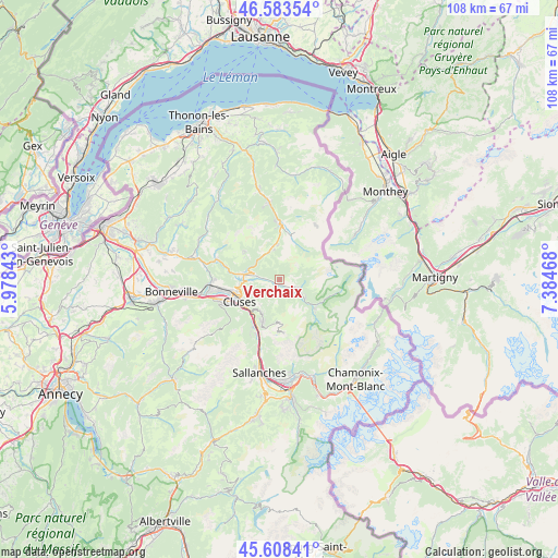
Verchaix GPS coordinates[2]
46° 5' 53.268" North, 6° 40' 53.616" East
| Map corner | latitude | longitude |
|---|---|---|
| Upper-left | 46.58354°, | 5.97843° |
| Center: | 46.09813°, | 6.68156° |
| Lower-right: | 45.60841°, | 7.38468° |
| Map W x H: | 108.4×108.4 km | = 67.4×67.4mi |
| max Lat: | 51.07786° ⇑65.1% North |
| Verchaix: | 46.09813° |
| min Lat: | ⇓34.9% South 41.3874° |
| min Long | Verchaix | max Long |
| -5.08615° | 6.68156° | 9.52242° |
| W 92.9%⇐ | ⇒7.1% E |
Elevation
Elevation of Verchaix is 785 m = 2575 ft, and this is 591.3 m = 1940 ft above average elevation for this country.
| Max E: |
2333 m = 7654 ft | 2.4% |
| Verchaix | 785 m 2575 ft | |
| Avg. | 193.7 m = 635 ft | |
Min E: |
-1 m = -3 ft | 97.6% |
See also: France elevation on elevation.city.
Geographical zone
Verchaix is located in North temperate zone (between Tropic of Cancer and the Arctic Circle). Distance of this North polar circle is 2275.5 km =1413.9 mi to North.| Distance of | km | miles | from Verchaix |
|---|---|---|---|
| North Pole | 4881.4 | 3033.2 | to North |
| Arctic Circle | 2275.5 | 1413.9 | to North |
| Tropic Cancer | 2519.7 | 1565.7 | to South |
| Equator | 5125.6 | 3184.9 | to South |


Nearby cities:
15 places around Verchaix: (largest is in red/bold)
• Arâches-la-Frasse
7.2 km =4.5 mi,  212°
212°
• Châtillon-sur-Cluses
7.9 km =4.9 mi,  261°
261°
• Cluses
9.1 km =5.7 mi,  244°
244°
• Les Gets
6.5 km =4 mi,  348°
348°
• Magland
9.8 km =6.1 mi, 208°
• Marnaz
12.6 km =7.8 mi,  252°
252°
• Mieussy
12.8 km =8 mi,  288°
288°
• Montriond
11.4 km =7.1 mi,  2°
2°
• Morillon
1.7 km =1.1 mi,  194°
194°
• Morzine
9.5 km =5.9 mi,  11°
11°
• Saint-Sigismond
5.9 km =3.7 mi, 243°
• Samoëns
3.9 km =2.4 mi,  116°
116°
• Scionzier
10.8 km =6.7 mi, 246°
• Taninges
7 km =4.3 mi,  279°
279°
• Thyez
11.2 km =7 mi, 261°
Sources, notices
• [Note1] Compared only with cities in France existing in our database
• [Src1] Map data: © OpenStreetMap contributors (CC-BY-SA)
• [Src2] Other city data from geonames.org with taken over terms of usage.
• [Src3] Geographical zone / Annual Mean Temperature by Robert A. Rohde @ Wikipedia
