Morillon geodata
Morillon (Auvergne-Rhône-Alpes) is a populated place; located in France in Europe/Paris (GMT+2) time zone. With population of 546 people, there are 14284 cities with bigger population in this country. Compared to other cities in France, 65.2% of cities are located further ↑North; 92.9% of cities are located further ←West and 96.6% of cities have lower elevation than Morillon. Note1
Administrative division(s):
- Level 1: Auvergne-Rhône-Alpes
- Level 2: Haute-Savoie
- Level 3: Arrondissement de Bonneville
- Level 4: Morillon


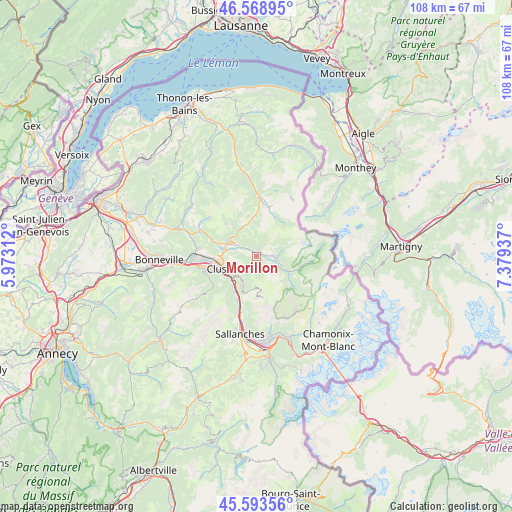
Morillon GPS coordinates[2]
46° 5' 0.276" North, 6° 40' 34.5" East
| Map corner | latitude | longitude |
|---|---|---|
| Upper-left | 46.56895°, | 5.97312° |
| Center: | 46.08341°, | 6.67625° |
| Lower-right: | 45.59356°, | 7.37937° |
| Map W x H: | 108.5×108.5 km | = 67.4×67.4mi |
| max Lat: | 51.07786° ⇑65.2% North |
| Morillon: | 46.08341° |
| min Lat: | ⇓34.8% South 41.3874° |
| min Long | Morillon | max Long |
| -5.08615° | 6.67625° | 9.52242° |
| W 92.9%⇐ | ⇒7.1% E |
Elevation
Elevation of Morillon is 688 m = 2257 ft, and this is 494.3 m = 1622 ft above average elevation for this country.
| Max E: |
2333 m = 7654 ft | 3.4% |
| Morillon | 688 m 2257 ft | |
| Avg. | 193.7 m = 635 ft | |
Min E: |
-1 m = -3 ft | 96.6% |
See also: France elevation on elevation.city.
Geographical zone
Morillon is located in North temperate zone (between Tropic of Cancer and the Arctic Circle). Distance of this North polar circle is 2277.2 km =1415 mi to North.| Distance of | km | miles | from Morillon |
|---|---|---|---|
| North Pole | 4883.1 | 3034.2 | to North |
| Arctic Circle | 2277.2 | 1415 | to North |
| Tropic Cancer | 2518.1 | 1564.7 | to South |
| Equator | 5124 | 3183.9 | to South |


Nearby cities:
15 places around Morillon: (largest is in red/bold)
• Arâches-la-Frasse
5.7 km =3.5 mi,  217°
217°
• Châtillon-sur-Cluses
7.4 km =4.6 mi,  273°
273°
• Cluses
8.2 km =5.1 mi,  253°
253°
• Les Gets
8 km =5 mi,  353°
353°
• Magland
8.2 km =5.1 mi,  211°
211°
• Marnaz
11.8 km =7.3 mi,  259°
259°
• Mieussy
13 km =8.1 mi,  295°
295°
• Montriond
13.1 km =8.1 mi,  3°
3°
• Morzine
11.2 km =7 mi,  12°
12°
• Saint-Sigismond
5 km =3.1 mi, 258°
• Samoëns
3.9 km =2.4 mi,  90°
90°
• Scionzier
9.9 km =6.2 mi, 254°
• Taninges
7.1 km =4.4 mi,  293°
293°
• Thyez
10.7 km =6.6 mi, 269°
• Verchaix
1.7 km =1.1 mi, 14°
Sources, notices
• [Note1] Compared only with cities in France existing in our database
• [Src1] Map data: © OpenStreetMap contributors (CC-BY-SA)
• [Src2] Other city data from geonames.org with taken over terms of usage.
• [Src3] Geographical zone / Annual Mean Temperature by Robert A. Rohde @ Wikipedia
