Vallangoujard geodata
Vallangoujard (Île-de-France) is a populated place; located in France in Europe/Paris (GMT+2) time zone. With population of 674 people, there are 12156 cities with bigger population in this country. Compared to other cities in France, 83% of cities are located further ↓South; 55.6% of cities are located further →East and 81.5% of cities have higher elevation than Vallangoujard. Note1
Administrative division(s):
- Level 1: Île-de-France
- Level 2: Département du Val-d’Oise
- Level 3: Arrondissement de Pontoise
- Level 4: Vallangoujard


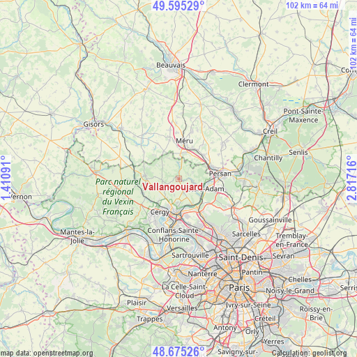
Vallangoujard GPS coordinates[2]
49° 8' 14.676" North, 2° 6' 50.508" East
| Map corner | latitude | longitude |
|---|---|---|
| Upper-left | 49.59529°, | 1.41091° |
| Center: | 49.13741°, | 2.11403° |
| Lower-right: | 48.67526°, | 2.81716° |
| Map W x H: | 102.3×102.3 km | = 63.6×63.6mi |
| max Lat: | 51.07786° ⇑17% North |
| Vallangoujard: | 49.13741° |
| min Lat: | ⇓83% South 41.3874° |
| min Long | Vallangoujard | max Long |
| -5.08615° | 2.11403° | 9.52242° |
| W 44.4%⇐ | ⇒55.6% E |
Elevation
Elevation of Vallangoujard is 51 m = 167 ft, and this is 142.7 m = 468 ft below average elevation for this country.
| Max E: |
2333 m = 7654 ft | 81.5% |
| Avg. | 193.7 m = 635 ft | |
| Vallangoujard | 51 m = 167 ft | |
Min E: |
-1 m = -3 ft | 18.5% |
See also: France elevation on elevation.city.
Geographical zone
Vallangoujard is located in North temperate zone (between Tropic of Cancer and the Arctic Circle). Distance of this North polar circle is 1937.6 km =1204 mi to North.| Distance of | km | miles | from Vallangoujard |
|---|---|---|---|
| North Pole | 4543.5 | 2823.2 | to North |
| Arctic Circle | 1937.6 | 1204 | to North |
| Tropic Cancer | 2857.6 | 1775.6 | to South |
| Equator | 5463.6 | 3394.9 | to South |


Nearby cities:
15 places around Vallangoujard: (largest is in red/bold)
• Amblainville
7.5 km =4.7 mi,  4°
4°
• Arronville
4.7 km =2.9 mi,  359°
359°
• Auvers-sur-Oise
8.4 km =5.2 mi,  150°
150°
• Butry-sur-Oise
8.3 km =5.2 mi,  131°
131°
• Cormeilles-en-Vexin
7.3 km =4.5 mi,  250°
250°
• Ennery
7 km =4.3 mi,  184°
184°
• Grisy-les-Plâtres
4.7 km =2.9 mi,  262°
262°
• Génicourt
6.4 km =4 mi,  211°
211°
• Hérouville
4.2 km =2.6 mi,  161°
161°
• Labbeville
2.2 km =1.4 mi,  94°
94°
• Nesles-la-Vallée
4.2 km =2.6 mi,  98°
98°
• Osny
8.4 km =5.2 mi, 206°
• Parmain
7.8 km =4.8 mi,  110°
110°
• Valmondois
7.1 km =4.4 mi, 128°
• Épiais-Rhus
4.1 km =2.5 mi, 246°
Sources, notices
• [Note1] Compared only with cities in France existing in our database
• [Src1] Map data: © OpenStreetMap contributors (CC-BY-SA)
• [Src2] Other city data from geonames.org with taken over terms of usage.
• [Src3] Geographical zone / Annual Mean Temperature by Robert A. Rohde @ Wikipedia
