Tourlaville geodata
Tourlaville (Normandy) is a populated place; located in France in Europe/Paris (GMT+2) time zone. With population of 18,273 people, there are 519 cities with bigger population in this country. Compared to other cities in France, 91% of cities are located further ↓South; 92.7% of cities are located further →East and 91.2% of cities have higher elevation than Tourlaville. Note1
Administrative division(s):
- Level 1: Normandy
- Level 2: Manche
- Level 3: Arrondissement de Cherbourg
- Level 4: Cherbourg-en-Cotentin


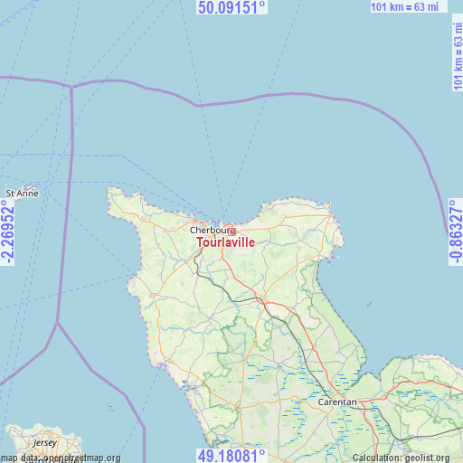
Tourlaville GPS coordinates[2]
49° 38' 17.844" North, 1° 33' 59.004" West
| Map corner | latitude | longitude |
|---|---|---|
| Upper-left | 50.09151°, | -2.26952° |
| Center: | 49.63829°, | -1.56639° |
| Lower-right: | 49.18081°, | -0.86327° |
| Map W x H: | 101.3×101.3 km | = 62.9×62.9mi |
| max Lat: | 51.07786° ⇑9% North |
| Tourlaville: | 49.63829° |
| min Lat: | ⇓91% South 41.3874° |
| min Long | Tourlaville | max Long |
| -5.08615° | -1.56639° | 9.52242° |
| W 7.3%⇐ | ⇒92.7% E |
Elevation
Elevation of Tourlaville is 27 m = 89 ft, and this is 166.7 m = 547 ft below average elevation for this country.
| Max E: |
2333 m = 7654 ft | 91.2% |
| Avg. | 193.7 m = 635 ft | |
| Tourlaville | 27 m = 89 ft | |
Min E: |
-1 m = -3 ft | 8.8% |
See also: France elevation on elevation.city.
Geographical zone
Tourlaville is located in North temperate zone (between Tropic of Cancer and the Arctic Circle). Distance of this North polar circle is 1881.9 km =1169.4 mi to North.| Distance of | km | miles | from Tourlaville |
|---|---|---|---|
| North Pole | 4487.8 | 2788.6 | to North |
| Arctic Circle | 1881.9 | 1169.4 | to North |
| Tropic Cancer | 2913.3 | 1810.2 | to South |
| Equator | 5519.3 | 3429.5 | to South |


Nearby cities:
15 places around Tourlaville: (largest is in red/bold)
• Bretteville
3.2 km =2 mi,  56°
56°
• Cherbourg-Octeville
3.6 km =2.2 mi,  272°
272°
• Digosville
3 km =1.9 mi,  105°
105°
• Fermanville
9.2 km =5.7 mi,  54°
54°
• Gonneville
7.3 km =4.5 mi,  88°
88°
• Hardinvast
8.9 km =5.5 mi,  221°
221°
• La Glacerie
3.8 km =2.4 mi,  196°
196°
• Le Mesnil-au-Val
4.6 km =2.9 mi,  140°
140°
• Le Theil
7.6 km =4.7 mi, 114°
• Martinvast
8.5 km =5.3 mi,  236°
236°
• Nouainville
8.6 km =5.3 mi,  257°
257°
• Octeville
5.7 km =3.5 mi, 256°
• Querqueville
9.4 km =5.8 mi,  286°
286°
• Tollevast
8.4 km =5.2 mi,  211°
211°
• Équeurdreville-Hainneville
6.3 km =3.9 mi,  280°
280°
Sources, notices
• [Note1] Compared only with cities in France existing in our database
• [Src1] Map data: © OpenStreetMap contributors (CC-BY-SA)
• [Src2] Other city data from geonames.org with taken over terms of usage.
• [Src3] Geographical zone / Annual Mean Temperature by Robert A. Rohde @ Wikipedia
