Octeville geodata
Octeville (Normandy) is a populated place; located in France in Europe/Paris (GMT+2) time zone. With population of 16,951 people, there are 561 cities with bigger population in this country. Compared to other cities in France, 90.9% of cities are located further ↓South; 93.2% of cities are located further →East and 62.8% of cities have higher elevation than Octeville. Note1
Administrative division(s):
- Level 1: Normandy
- Level 2: Manche
- Level 3: Arrondissement de Cherbourg
- Level 4: Cherbourg-en-Cotentin


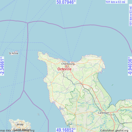
Octeville GPS coordinates[2]
49° 37' 34.032" North, 1° 38' 36.564" West
| Map corner | latitude | longitude |
|---|---|---|
| Upper-left | 50.07946°, | -2.34661° |
| Center: | 49.62612°, | -1.64349° |
| Lower-right: | 49.16852°, | -0.94036° |
| Map W x H: | 101.3×101.3 km | = 62.9×62.9mi |
| max Lat: | 51.07786° ⇑9.1% North |
| Octeville: | 49.62612° |
| min Lat: | ⇓90.9% South 41.3874° |
| min Long | Octeville | max Long |
| -5.08615° | -1.64349° | 9.52242° |
| W 6.8%⇐ | ⇒93.2% E |
Elevation
Elevation of Octeville is 95 m = 312 ft, and this is 98.7 m = 324 ft below average elevation for this country.
| Max E: |
2333 m = 7654 ft | 62.8% |
| Avg. | 193.7 m = 635 ft | |
| Octeville | 95 m = 312 ft | |
Min E: |
-1 m = -3 ft | 37.2% |
See also: France elevation on elevation.city.
Geographical zone
Octeville is located in North temperate zone (between Tropic of Cancer and the Arctic Circle). Distance of this North polar circle is 1883.3 km =1170.2 mi to North.| Distance of | km | miles | from Octeville |
|---|---|---|---|
| North Pole | 4489.2 | 2789.5 | to North |
| Arctic Circle | 1883.3 | 1170.2 | to North |
| Tropic Cancer | 2912 | 1809.4 | to South |
| Equator | 5517.9 | 3428.7 | to South |


Nearby cities:
15 places around Octeville: (largest is in red/bold)
• Acqueville
7.9 km =4.9 mi,  255°
255°
• Cherbourg-Octeville
2.5 km =1.6 mi,  52°
52°
• Digosville
8.5 km =5.3 mi,  86°
86°
• Flottemanville-Hague
5.7 km =3.5 mi, 264°
• Hardinvast
5.3 km =3.3 mi,  183°
183°
• La Glacerie
5 km =3.1 mi,  117°
117°
• Martinvast
3.7 km =2.3 mi,  204°
204°
• Nouainville
2.9 km =1.8 mi, 258°
• Querqueville
5.3 km =3.3 mi,  319°
319°
• Sideville
4.9 km =3 mi,  214°
214°
• Teurthéville-Hague
7.8 km =4.8 mi,  231°
231°
• Tollevast
5.9 km =3.7 mi,  168°
168°
• Tonneville
5.5 km =3.4 mi,  290°
290°
• Tourlaville
5.7 km =3.5 mi,  76°
76°
• Équeurdreville-Hainneville
2.6 km =1.6 mi,  344°
344°
Sources, notices
• [Note1] Compared only with cities in France existing in our database
• [Src1] Map data: © OpenStreetMap contributors (CC-BY-SA)
• [Src2] Other city data from geonames.org with taken over terms of usage.
• [Src3] Geographical zone / Annual Mean Temperature by Robert A. Rohde @ Wikipedia
