Souligné-sous-Ballon geodata
Souligné-sous-Ballon (Pays de la Loire) is a populated place; located in France in Europe/Paris (GMT+2) time zone. With population of 1,060 people, there are 8398 cities with bigger population in this country. Compared to other cities in France, 61.8% of cities are located further ↓South; 75.9% of cities are located further →East and 73.1% of cities have higher elevation than Souligné-sous-Ballon. Note1
Administrative division(s):
- Level 1: Pays de la Loire
- Level 2: Sarthe
- Level 3: Arrondissement du Mans
- Level 4: Souligné-sous-Ballon


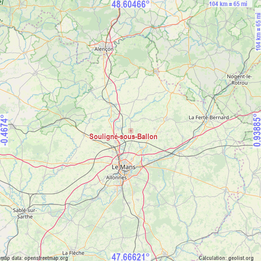
Souligné-sous-Ballon GPS coordinates[2]
48° 8' 15.288" North, 0° 14' 8.592" East
| Map corner | latitude | longitude |
|---|---|---|
| Upper-left | 48.60466°, | -0.4674° |
| Center: | 48.13758°, | 0.23572° |
| Lower-right: | 47.66621°, | 0.93885° |
| Map W x H: | 104.3×104.3 km | = 64.8×64.8mi |
| max Lat: | 51.07786° ⇑38.2% North |
| Souligné-sous-Ballon: | 48.13758° |
| min Lat: | ⇓61.8% South 41.3874° |
| min Long | Souligné-sous- | max Long |
| -5.08615° | 0.23572° | 9.52242° |
| W 24.1%⇐ | ⇒75.9% E |
Elevation
Elevation of Souligné-sous-Ballon is 71 m = 233 ft, and this is 122.7 m = 403 ft below average elevation for this country.
| Max E: |
2333 m = 7654 ft | 73.1% |
| Avg. | 193.7 m = 635 ft | |
| Souligné-sous-Ballon | 71 m = 233 ft | |
Min E: |
-1 m = -3 ft | 26.9% |
See also: France elevation on elevation.city.
Geographical zone
Souligné-sous-Ballon is located in North temperate zone (between Tropic of Cancer and the Arctic Circle). Distance of this North polar circle is 2048.8 km =1273.1 mi to North.| Distance of | km | miles | from Souligné-sous-Ballon |
|---|---|---|---|
| North Pole | 4654.7 | 2892.3 | to North |
| Arctic Circle | 2048.8 | 1273.1 | to North |
| Tropic Cancer | 2746.5 | 1706.6 | to South |
| Equator | 5352.4 | 3325.8 | to South |


Nearby cities:
15 places around Souligné-sous-Ballon: (largest is in red/bold)
• Ballon
4 km =2.5 mi,  2°
2°
• Beaufay
9.4 km =5.8 mi,  83°
83°
• Courcemont
9.6 km =6 mi,  65°
65°
• La Bazoge
7.5 km =4.7 mi,  232°
232°
• La Guierche
4 km =2.5 mi, 231°
• La Milesse
11.2 km =7 mi,  222°
222°
• Maresché
10.3 km =6.4 mi,  323°
323°
• Montbizot
4.1 km =2.5 mi,  289°
289°
• Neuville-sur-Sarthe
7.5 km =4.7 mi,  205°
205°
• Saint-Corneille
11.3 km =7 mi,  134°
134°
• Saint-Mars-sous-Ballon
3.9 km =2.4 mi,  12°
12°
• Saint-Saturnin
10.8 km =6.7 mi, 215°
• Sainte-Jamme-sur-Sarthe
5.1 km =3.2 mi,  276°
276°
• Sainte-Sabine-sur-Longève
10.5 km =6.5 mi,  272°
272°
• Sillé-le-Philippe
9.2 km =5.7 mi,  111°
111°
Sources, notices
• [Note1] Compared only with cities in France existing in our database
• [Src1] Map data: © OpenStreetMap contributors (CC-BY-SA)
• [Src2] Other city data from geonames.org with taken over terms of usage.
• [Src3] Geographical zone / Annual Mean Temperature by Robert A. Rohde @ Wikipedia
