Séchilienne geodata
Séchilienne (Auvergne-Rhône-Alpes) is a populated place; located in France in Europe/Paris (GMT+2) time zone. With population of 820 people, there are 10392 cities with bigger population in this country. Compared to other cities in France, 79% of cities are located further ↑North; 85.4% of cities are located further ←West and 87.5% of cities have lower elevation than Séchilienne. Note1
Administrative division(s):
- Level 1: Auvergne-Rhône-Alpes
- Level 2: Département de l'Isère
- Level 3: Arrondissement de Grenoble
- Level 4: Séchilienne


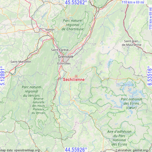
Séchilienne GPS coordinates[2]
45° 3' 29.16" North, 5° 49' 55.344" East
| Map corner | latitude | longitude |
|---|---|---|
| Upper-left | 45.55262°, | 5.12891° |
| Center: | 45.0581°, | 5.83204° |
| Lower-right: | 44.55926°, | 6.53516° |
| Map W x H: | 110.5×110.4 km | = 68.7×68.6mi |
| max Lat: | 51.07786° ⇑79% North |
| Séchilienne: | 45.0581° |
| min Lat: | ⇓21% South 41.3874° |
| min Long | Séchilienne | max Long |
| -5.08615° | 5.83204° | 9.52242° |
| W 85.4%⇐ | ⇒14.6% E |
Elevation
Elevation of Séchilienne is 381 m = 1250 ft, and this is 187.3 m = 615 ft above average elevation for this country.
| Max E: |
2333 m = 7654 ft | 12.5% |
| Séchilienne | 381 m 1250 ft | |
| Avg. | 193.7 m = 635 ft | |
Min E: |
-1 m = -3 ft | 87.5% |
See also: France elevation on elevation.city.
Geographical zone
Séchilienne is located in North temperate zone (between Tropic of Cancer and the Arctic Circle). Distance of this North polar circle is 2391.2 km =1485.8 mi to North.| Distance of | km | miles | from Séchilienne |
|---|---|---|---|
| North Pole | 4997.1 | 3105.1 | to North |
| Arctic Circle | 2391.2 | 1485.8 | to North |
| Tropic Cancer | 2404.1 | 1493.8 | to South |
| Equator | 5010 | 3113.1 | to South |


Nearby cities:
15 places around Séchilienne: (largest is in red/bold)
• Bresson
11 km =6.8 mi,  323°
323°
• Brié-et-Angonnes
8.3 km =5.2 mi,  332°
332°
• Champ-sur-Drac
8 km =5 mi,  279°
279°
• Champagnier
10.2 km =6.3 mi,  305°
305°
• Chamrousse
8.5 km =5.3 mi,  23°
23°
• Herbeys
9.6 km =6 mi,  341°
341°
• Jarrie
8.7 km =5.4 mi, 319°
• Livet-et-Gavet
9.7 km =6 mi,  55°
55°
• Notre-Dame-de-Mésage
5.8 km =3.6 mi,  274°
274°
• Saint-Barthélemy-de-Séchilienne
1 km =0.6 mi,  192°
192°
• Saint-Georges-de-Commiers
10 km =6.2 mi,  261°
261°
• Saint-Pierre-de-Mésage
3.5 km =2.2 mi,  248°
248°
• Vaulnaveys-le-Bas
4.7 km =2.9 mi,  353°
353°
• Vaulnaveys-le-Haut
7.6 km =4.7 mi, 351°
• Vizille
5.3 km =3.3 mi,  294°
294°
Sources, notices
• [Note1] Compared only with cities in France existing in our database
• [Src1] Map data: © OpenStreetMap contributors (CC-BY-SA)
• [Src2] Other city data from geonames.org with taken over terms of usage.
• [Src3] Geographical zone / Annual Mean Temperature by Robert A. Rohde @ Wikipedia
