Vaulnaveys-le-Bas geodata
Vaulnaveys-le-Bas (Auvergne-Rhône-Alpes) is a populated place; located in France in Europe/Paris (GMT+2) time zone. With population of 1,258 people, there are 7239 cities with bigger population in this country. Compared to other cities in France, 78.5% of cities are located further ↑North; 85.3% of cities are located further ←West and 98.6% of cities have lower elevation than Vaulnaveys-le-Bas. Note1
Administrative division(s):
- Level 1: Auvergne-Rhône-Alpes
- Level 2: Département de l'Isère
- Level 3: Arrondissement de Grenoble
- Level 4: Vaulnaveys-le-Bas


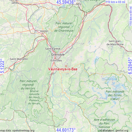
Vaulnaveys-le-Bas GPS coordinates[2]
45° 6' 0.72" North, 5° 49' 31.152" East
| Map corner | latitude | longitude |
|---|---|---|
| Upper-left | 45.59436°, | 5.1222° |
| Center: | 45.1002°, | 5.82532° |
| Lower-right: | 44.60173°, | 6.52845° |
| Map W x H: | 110.4×110.4 km | = 68.6×68.6mi |
| max Lat: | 51.07786° ⇑78.5% North |
| Vaulnaveys-le-Bas: | 45.1002° |
| min Lat: | ⇓21.5% South 41.3874° |
| min Long | Vaulnaveys-le-B | max Long |
| -5.08615° | 5.82532° | 9.52242° |
| W 85.3%⇐ | ⇒14.7% E |
Elevation
Elevation of Vaulnaveys-le-Bas is 904 m = 2966 ft, and this is 710.3 m = 2330 ft above average elevation for this country.
| Max E: |
2333 m = 7654 ft | 1.4% |
| Vaulnaveys-le-Bas | 904 m 2966 ft | |
| Avg. | 193.7 m = 635 ft | |
Min E: |
-1 m = -3 ft | 98.6% |
See also: France elevation on elevation.city.
Geographical zone
Vaulnaveys-le-Bas is located in North temperate zone (between Tropic of Cancer and the Arctic Circle). Distance of this North polar circle is 2386.5 km =1482.9 mi to North.| Distance of | km | miles | from Vaulnaveys-le-Bas |
|---|---|---|---|
| North Pole | 4992.4 | 3102.1 | to North |
| Arctic Circle | 2386.5 | 1482.9 | to North |
| Tropic Cancer | 2408.8 | 1496.8 | to South |
| Equator | 5014.7 | 3116 | to South |


Nearby cities:
15 places around Vaulnaveys-le-Bas: (largest is in red/bold)
• Bresson
7.4 km =4.6 mi,  304°
304°
• Brié-et-Angonnes
4.2 km =2.6 mi,  309°
309°
• Champ-sur-Drac
8.1 km =5 mi,  245°
245°
• Champagnier
7.8 km =4.8 mi,  279°
279°
• Chamrousse
5 km =3.1 mi,  51°
51°
• Eybens
7.9 km =4.9 mi, 311°
• Herbeys
5.1 km =3.2 mi,  330°
330°
• Jarrie
5.5 km =3.4 mi,  290°
290°
• Notre-Dame-de-Mésage
6.7 km =4.2 mi,  231°
231°
• Poisat
8.2 km =5.1 mi,  321°
321°
• Saint-Barthélemy-de-Séchilienne
5.7 km =3.5 mi,  176°
176°
• Saint-Pierre-de-Mésage
6.6 km =4.1 mi,  204°
204°
• Séchilienne
4.7 km =2.9 mi,  173°
173°
• Vaulnaveys-le-Haut
2.9 km =1.8 mi,  347°
347°
• Vizille
4.9 km =3 mi,  240°
240°
Sources, notices
• [Note1] Compared only with cities in France existing in our database
• [Src1] Map data: © OpenStreetMap contributors (CC-BY-SA)
• [Src2] Other city data from geonames.org with taken over terms of usage.
• [Src3] Geographical zone / Annual Mean Temperature by Robert A. Rohde @ Wikipedia
