Savigny-Lévescault geodata
Savigny-Lévescault (Nouvelle-Aquitaine) is a populated place; located in France in Europe/Paris (GMT+2) time zone. With population of 1,007 people, there are 8791 cities with bigger population in this country. Compared to other cities in France, 59.8% of cities are located further ↑North; 73.6% of cities are located further →East and 55.6% of cities have higher elevation than Savigny-Lévescault. Note1
Administrative division(s):
- Level 1: Nouvelle-Aquitaine
- Level 2: Vienne
- Level 3: Arrondissement de Poitiers
- Level 4: Savigny-Lévescault


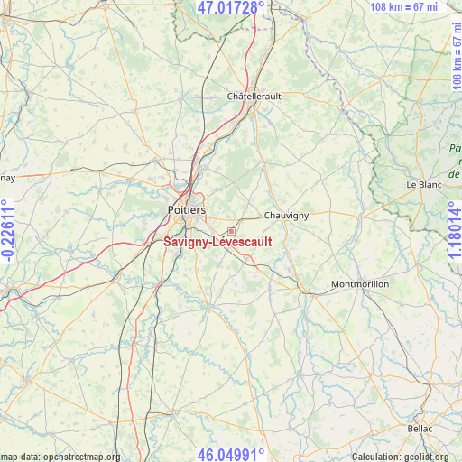
Savigny-Lévescault GPS coordinates[2]
46° 32' 8.7" North, 0° 28' 37.236" East
| Map corner | latitude | longitude |
|---|---|---|
| Upper-left | 47.01728°, | -0.22611° |
| Center: | 46.53575°, | 0.47701° |
| Lower-right: | 46.04991°, | 1.18014° |
| Map W x H: | 107.6×107.6 km | = 66.9×66.9mi |
| max Lat: | 51.07786° ⇑59.8% North |
| Savigny-Lévescault: | 46.53575° |
| min Lat: | ⇓40.2% South 41.3874° |
| min Long | Savigny-Lévesc | max Long |
| -5.08615° | 0.47701° | 9.52242° |
| W 26.4%⇐ | ⇒73.6% E |
Elevation
Elevation of Savigny-Lévescault is 115 m = 377 ft, and this is 78.7 m = 258 ft below average elevation for this country.
| Max E: |
2333 m = 7654 ft | 55.6% |
| Avg. | 193.7 m = 635 ft | |
| Savigny-Lévescault | 115 m = 377 ft | |
Min E: |
-1 m = -3 ft | 44.4% |
See also: France elevation on elevation.city.
Geographical zone
Savigny-Lévescault is located in North temperate zone (between Tropic of Cancer and the Arctic Circle). Distance of this North polar circle is 2226.9 km =1383.7 mi to North.| Distance of | km | miles | from Savigny-Lévescault |
|---|---|---|---|
| North Pole | 4832.8 | 3003 | to North |
| Arctic Circle | 2226.9 | 1383.7 | to North |
| Tropic Cancer | 2568.4 | 1595.9 | to South |
| Equator | 5174.3 | 3215.2 | to South |


Nearby cities:
15 places around Savigny-Lévescault: (largest is in red/bold)
• Bignoux
7.1 km =4.4 mi,  355°
355°
• Buxerolles
9 km =5.6 mi,  3°
3°
• Fleuré
7.3 km =4.5 mi,  152°
152°
• Jardres
7.6 km =4.7 mi,  61°
61°
• Lavoux
7.9 km =4.9 mi,  30°
30°
• Liniers
9.5 km =5.9 mi, 28°
• Mignaloux-Beauvoir
4.9 km =3 mi,  279°
279°
• Montamisé
10.3 km =6.4 mi,  337°
337°
• Nouaillé-Maupertuis
5.7 km =3.5 mi,  237°
237°
• Pouillé
7.6 km =4.7 mi,  89°
89°
• Roches-Prémarie-Andillé
10 km =6.2 mi, 235°
• Saint-Benoît
10.5 km =6.5 mi, 278°
• Smarves
10.1 km =6.3 mi,  254°
254°
• Sèvres-Anxaumont
3.8 km =2.4 mi,  346°
346°
• Tercé
7 km =4.3 mi,  107°
107°
Sources, notices
• [Note1] Compared only with cities in France existing in our database
• [Src1] Map data: © OpenStreetMap contributors (CC-BY-SA)
• [Src2] Other city data from geonames.org with taken over terms of usage.
• [Src3] Geographical zone / Annual Mean Temperature by Robert A. Rohde @ Wikipedia
