Roches-Prémarie-Andillé geodata
Roches-Prémarie-Andillé (Nouvelle-Aquitaine) is a populated place; located in France in Europe/Paris (GMT+2) time zone. With population of 1,602 people, there are 5826 cities with bigger population in this country. Compared to other cities in France, 60.2% of cities are located further ↑North; 74.6% of cities are located further →East and 53.8% of cities have higher elevation than Roches-Prémarie-Andillé. Note1
Administrative division(s):
- Level 1: Nouvelle-Aquitaine
- Level 2: Vienne
- Level 3: Arrondissement de Poitiers
- Level 4: Roches-Prémarie-Andillé
Current local time in Roches-Prémarie-Andillé:
09:58 AM, SaturdayDifference from your time zone: hours


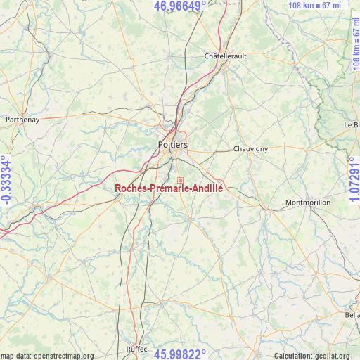
Roches-Prémarie-Andillé GPS coordinates[2]
46° 29' 4.236" North, 0° 22' 11.244" East
| Map corner | latitude | longitude |
|---|---|---|
| Upper-left | 46.96649°, | -0.33334° |
| Center: | 46.48451°, | 0.36979° |
| Lower-right: | 45.99822°, | 1.07291° |
| Map W x H: | 107.7×107.7 km | = 66.9×66.9mi |
| max Lat: | 51.07786° ⇑60.2% North |
| Roches-Prémarie-Andillé: | 46.48451° |
| min Lat: | ⇓39.8% South 41.3874° |
| min Long | Roches-Prémari | max Long |
| -5.08615° | 0.36979° | 9.52242° |
| W 25.4%⇐ | ⇒74.6% E |
Elevation
Elevation of Roches-Prémarie-Andillé is 120 m = 394 ft, and this is 73.7 m = 242 ft below average elevation for this country.
| Max E: |
2333 m = 7654 ft | 53.8% |
| Avg. | 193.7 m = 635 ft | |
| Roches-Prémarie-Andillé | 120 m = 394 ft | |
Min E: |
-1 m = -3 ft | 46.2% |
See also: France elevation on elevation.city.
Geographical zone
Roches-Prémarie-Andillé is located in North temperate zone (between Tropic of Cancer and the Arctic Circle). Distance of this North polar circle is 2232.6 km =1387.3 mi to North.| Distance of | km | miles | from Roches-Prémarie-Andillé |
|---|---|---|---|
| North Pole | 4838.5 | 3006.5 | to North |
| Arctic Circle | 2232.6 | 1387.3 | to North |
| Tropic Cancer | 2562.7 | 1592.4 | to South |
| Equator | 5168.6 | 3211.6 | to South |


Nearby cities:
15 places around Roches-Prémarie-Andillé: (largest is in red/bold)
• Aslonnes
9.8 km =6.1 mi,  196°
196°
• Château-Larcher
8.6 km =5.3 mi,  209°
209°
• Croutelle
8.7 km =5.4 mi,  315°
315°
• Fontaine-le-Comte
9.7 km =6 mi,  302°
302°
• Iteuil
4.5 km =2.8 mi,  275°
275°
• La Villedieu-du-Clain
3.2 km =2 mi,  180°
180°
• Ligugé
5.1 km =3.2 mi, 319°
• Marnay
10.1 km =6.3 mi,  192°
192°
• Mignaloux-Beauvoir
7.4 km =4.6 mi,  27°
27°
• Nouaillé-Maupertuis
4.3 km =2.7 mi,  52°
52°
• Saint-Benoît
7.6 km =4.7 mi,  343°
343°
• Savigny-Lévescault
10 km =6.2 mi,  55°
55°
• Smarves
3.3 km =2.1 mi,  333°
333°
• Vernon
9.5 km =5.9 mi,  121°
121°
• Vivonne
10.1 km =6.3 mi,  233°
233°
Sources, notices
• [Note1] Compared only with cities in France existing in our database
• [Src1] Map data: © OpenStreetMap contributors (CC-BY-SA)
• [Src2] Other city data from geonames.org with taken over terms of usage.
• [Src3] Geographical zone / Annual Mean Temperature by Robert A. Rohde @ Wikipedia
