Sauzet geodata
Sauzet (Auvergne-Rhône-Alpes) is a populated place; located in France in Europe/Paris (GMT+2) time zone. With population of 1,819 people, there are 5216 cities with bigger population in this country. Compared to other cities in France, 82.8% of cities are located further ↑North; 75.4% of cities are located further ←West and 50.2% of cities have higher elevation than Sauzet. Note1
Administrative division(s):
- Level 1: Auvergne-Rhône-Alpes
- Level 2: Département de la Drôme
- Level 3: Arrondissement de Nyons
- Level 4: Sauzet


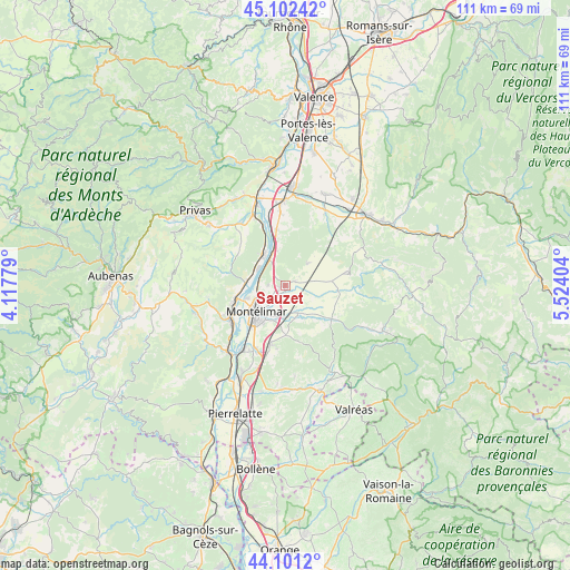
Sauzet GPS coordinates[2]
44° 36' 14.292" North, 4° 49' 15.276" East
| Map corner | latitude | longitude |
|---|---|---|
| Upper-left | 45.10242°, | 4.11779° |
| Center: | 44.60397°, | 4.82091° |
| Lower-right: | 44.1012°, | 5.52404° |
| Map W x H: | 111.3×111.3 km | = 69.2×69.2mi |
| max Lat: | 51.07786° ⇑82.8% North |
| Sauzet: | 44.60397° |
| min Lat: | ⇓17.2% South 41.3874° |
| min Long | Sauzet | max Long |
| -5.08615° | 4.82091° | 9.52242° |
| W 75.4%⇐ | ⇒24.6% E |
Elevation
Elevation of Sauzet is 131 m = 430 ft, and this is 62.7 m = 206 ft below average elevation for this country.
| Max E: |
2333 m = 7654 ft | 50.2% |
| Avg. | 193.7 m = 635 ft | |
| Sauzet | 131 m = 430 ft | |
Min E: |
-1 m = -3 ft | 49.8% |
See also: France elevation on elevation.city.
Geographical zone
Sauzet is located in North temperate zone (between Tropic of Cancer and the Arctic Circle). Distance of this Northern Tropic circle is 2353.6 km =1462.5 mi to South.| Distance of | km | miles | from Sauzet |
|---|---|---|---|
| North Pole | 5047.6 | 3136.4 | to North |
| Arctic Circle | 2441.7 | 1517.2 | to North |
| Tropic Cancer | 2353.6 | 1462.5 | to South |
| Equator | 4959.5 | 3081.7 | to South |


Nearby cities:
15 places around Sauzet: (largest is in red/bold)
• Ancône
7.9 km =4.9 mi,  251°
251°
• Cléon-d’Andran
9.1 km =5.7 mi,  84°
84°
• Cruas
7.5 km =4.7 mi,  322°
322°
• Espeluche
9.7 km =6 mi,  179°
179°
• La Bâtie-Rolland
6.6 km =4.1 mi,  148°
148°
• La Coucourde
5.8 km =3.6 mi,  328°
328°
• La Laupie
2 km =1.2 mi,  95°
95°
• Marsanne
6 km =3.7 mi,  45°
45°
• Meysse
7.8 km =4.8 mi,  275°
275°
• Montboucher-sur-Jabron
6.1 km =3.8 mi,  194°
194°
• Montélimar
7.6 km =4.7 mi,  223°
223°
• Rochemaure
9.4 km =5.8 mi,  258°
258°
• Saint-Gervais-sur-Roubion
5.8 km =3.6 mi,  114°
114°
• Saint-Marcel-lès-Sauzet
1.4 km =0.9 mi,  239°
239°
• Savasse
3.5 km =2.2 mi,  270°
270°
Sources, notices
• [Note1] Compared only with cities in France existing in our database
• [Src1] Map data: © OpenStreetMap contributors (CC-BY-SA)
• [Src2] Other city data from geonames.org with taken over terms of usage.
• [Src3] Geographical zone / Annual Mean Temperature by Robert A. Rohde @ Wikipedia
