La Bâtie-Rolland geodata
La Bâtie-Rolland (Auvergne-Rhône-Alpes) is a populated place; located in France in Europe/Paris (GMT+2) time zone. With population of 867 people, there are 9921 cities with bigger population in this country. Compared to other cities in France, 83.2% of cities are located further ↑North; 76% of cities are located further ←West and 57.6% of cities have lower elevation than La Bâtie-Rolland. Note1
Administrative division(s):
- Level 1: Auvergne-Rhône-Alpes
- Level 2: Département de la Drôme
- Level 3: Arrondissement de Nyons
- Level 4: La Bâtie-Rolland


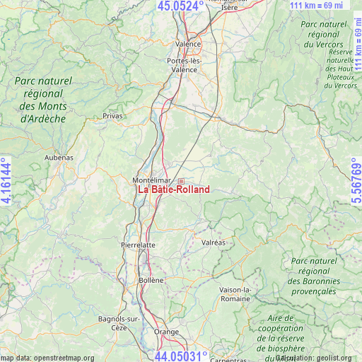
La Bâtie-Rolland GPS coordinates[2]
44° 33' 12.636" North, 4° 51' 52.452" East
| Map corner | latitude | longitude |
|---|---|---|
| Upper-left | 45.0524°, | 4.16144° |
| Center: | 44.55351°, | 4.86457° |
| Lower-right: | 44.05031°, | 5.56769° |
| Map W x H: | 111.4×111.4 km | = 69.2×69.2mi |
| max Lat: | 51.07786° ⇑83.2% North |
| La Bâtie-Rolland: | 44.55351° |
| min Lat: | ⇓16.8% South 41.3874° |
| min Long | La Bâtie-Rolla | max Long |
| -5.08615° | 4.86457° | 9.52242° |
| W 76%⇐ | ⇒24% E |
Elevation
Elevation of La Bâtie-Rolland is 160 m = 525 ft, and this is 33.7 m = 111 ft below average elevation for this country.
| Max E: |
2333 m = 7654 ft | 42.4% |
| Avg. | 193.7 m = 635 ft | |
| La Bâtie-Rolland | 160 m = 525 ft | |
Min E: |
-1 m = -3 ft | 57.6% |
See also: France elevation on elevation.city.
Geographical zone
La Bâtie-Rolland is located in North temperate zone (between Tropic of Cancer and the Arctic Circle). Distance of this Northern Tropic circle is 2348 km =1459 mi to South.| Distance of | km | miles | from La Bâtie-Rolland |
|---|---|---|---|
| North Pole | 5053.2 | 3139.9 | to North |
| Arctic Circle | 2447.3 | 1520.7 | to North |
| Tropic Cancer | 2348 | 1459 | to South |
| Equator | 4953.9 | 3078.2 | to South |


Nearby cities:
15 places around La Bâtie-Rolland: (largest is in red/bold)
• Allan
8.6 km =5.3 mi,  223°
223°
• Ancône
11.3 km =7 mi,  285°
285°
• Charols
8.1 km =5 mi,  59°
59°
• Cléon-d’Andran
8.5 km =5.3 mi,  41°
41°
• Espeluche
5.3 km =3.3 mi, 220°
• La Bégude-de-Mazenc
5.6 km =3.5 mi,  102°
102°
• La Laupie
5.6 km =3.5 mi,  344°
344°
• Malataverne
11.6 km =7.2 mi,  229°
229°
• Marsanne
9.9 km =6.2 mi,  4°
4°
• Montboucher-sur-Jabron
5 km =3.1 mi,  266°
266°
• Montélimar
8.7 km =5.4 mi, 270°
• Saint-Gervais-sur-Roubion
3.7 km =2.3 mi,  30°
30°
• Saint-Marcel-lès-Sauzet
6.8 km =4.2 mi,  316°
316°
• Sauzet
6.6 km =4.1 mi,  328°
328°
• Savasse
9 km =5.6 mi,  308°
308°
Sources, notices
• [Note1] Compared only with cities in France existing in our database
• [Src1] Map data: © OpenStreetMap contributors (CC-BY-SA)
• [Src2] Other city data from geonames.org with taken over terms of usage.
• [Src3] Geographical zone / Annual Mean Temperature by Robert A. Rohde @ Wikipedia
