Saône geodata
Saône (Bourgogne-Franche-Comté) is a populated place; located in France in Europe/Paris (GMT+2) time zone. With population of 2,838 people, there are 3437 cities with bigger population in this country. Compared to other cities in France, 52.7% of cities are located further ↑North; 88.4% of cities are located further ←West and 88.7% of cities have lower elevation than Saône. Note1
Administrative division(s):
- Level 1: Bourgogne-Franche-Comté
- Level 2: Doubs
- Level 3: Arrondissement de Besançon
- Level 4: Saône


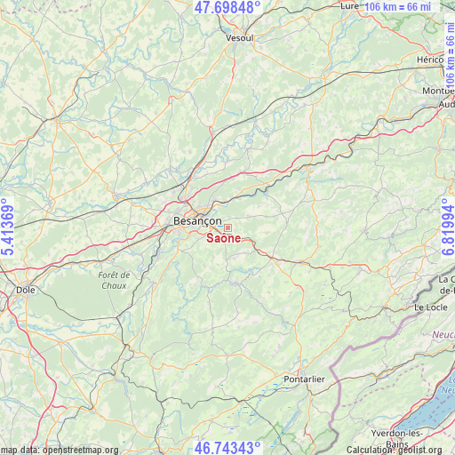
Saône GPS coordinates[2]
47° 13' 23.196" North, 6° 7' 0.552" East
| Map corner | latitude | longitude |
|---|---|---|
| Upper-left | 47.69848°, | 5.41369° |
| Center: | 47.22311°, | 6.11682° |
| Lower-right: | 46.74343°, | 6.81994° |
| Map W x H: | 106.2×106.2 km | = 66×66mi |
| max Lat: | 51.07786° ⇑52.7% North |
| Saône: | 47.22311° |
| min Lat: | ⇓47.3% South 41.3874° |
| min Long | Saône | max Long |
| -5.08615° | 6.11682° | 9.52242° |
| W 88.4%⇐ | ⇒11.6% E |
Elevation
Elevation of Saône is 401 m = 1316 ft, and this is 207.3 m = 680 ft above average elevation for this country.
| Max E: |
2333 m = 7654 ft | 11.3% |
| Saône | 401 m 1316 ft | |
| Avg. | 193.7 m = 635 ft | |
Min E: |
-1 m = -3 ft | 88.7% |
See also: France elevation on elevation.city.
Geographical zone
Saône is located in North temperate zone (between Tropic of Cancer and the Arctic Circle). Distance of this North polar circle is 2150.5 km =1336.3 mi to North.| Distance of | km | miles | from Saône |
|---|---|---|---|
| North Pole | 4756.3 | 2955.4 | to North |
| Arctic Circle | 2150.5 | 1336.3 | to North |
| Tropic Cancer | 2644.8 | 1643.4 | to South |
| Equator | 5250.7 | 3262.6 | to South |


Nearby cities:
15 places around Saône: (largest is in red/bold)
• Amagney
9.5 km =5.9 mi,  15°
15°
• Besançon
8 km =5 mi,  290°
290°
• Beure
8.6 km =5.3 mi,  257°
257°
• Bouclans
9.5 km =5.9 mi,  74°
74°
• Chalezeule
5 km =3.1 mi,  321°
321°
• Fontain
7.4 km =4.6 mi,  248°
248°
• Gennes
3 km =1.9 mi,  359°
359°
• Mamirolle
4.2 km =2.6 mi,  130°
130°
• Montfaucon
3 km =1.9 mi,  297°
297°
• Morre
3.2 km =2 mi,  275°
275°
• Nancray
5.6 km =3.5 mi,  63°
63°
• Novillars
6.9 km =4.3 mi,  7°
7°
• Roche-lez-Beaupré
6.7 km =4.2 mi, 359°
• Tarcenay
7.3 km =4.5 mi,  182°
182°
• Thise
7.4 km =4.6 mi,  338°
338°
Sources, notices
• [Note1] Compared only with cities in France existing in our database
• [Src1] Map data: © OpenStreetMap contributors (CC-BY-SA)
• [Src2] Other city data from geonames.org with taken over terms of usage.
• [Src3] Geographical zone / Annual Mean Temperature by Robert A. Rohde @ Wikipedia
