Sancey-le-Grand geodata
Sancey-le-Grand (Bourgogne-Franche-Comté) is a populated place; located in France in Europe/Paris (GMT+2) time zone. With population of 1,085 people, there are 8226 cities with bigger population in this country. Compared to other cities in France, 51.6% of cities are located further ↑North; 92.3% of cities are located further ←West and 93% of cities have lower elevation than Sancey-le-Grand. Note1
Administrative division(s):
- Level 1: Bourgogne-Franche-Comté
- Level 2: Doubs
- Level 3: Arrondissement de Montbéliard
- Level 4: Sancey


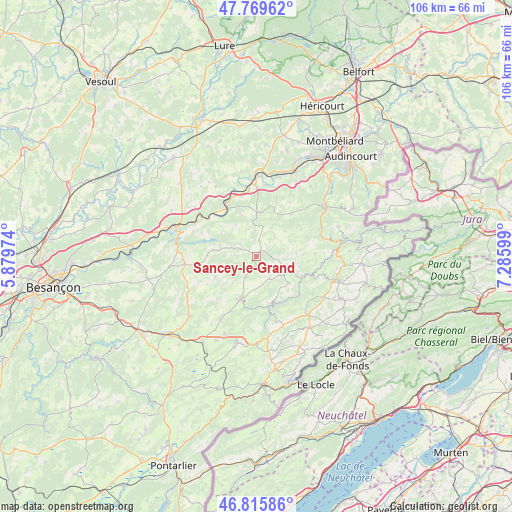
Sancey-le-Grand GPS coordinates[2]
47° 17' 41.604" North, 6° 34' 58.332" East
| Map corner | latitude | longitude |
|---|---|---|
| Upper-left | 47.76962°, | 5.87974° |
| Center: | 47.29489°, | 6.58287° |
| Lower-right: | 46.81586°, | 7.28599° |
| Map W x H: | 106×106 km | = 65.9×65.9mi |
| max Lat: | 51.07786° ⇑51.6% North |
| Sancey-le-Grand: | 47.29489° |
| min Lat: | ⇓48.4% South 41.3874° |
| min Long | Sancey-le-Grand | max Long |
| -5.08615° | 6.58287° | 9.52242° |
| W 92.3%⇐ | ⇒7.7% E |
Elevation
Elevation of Sancey-le-Grand is 503 m = 1650 ft, and this is 309.3 m = 1015 ft above average elevation for this country.
| Max E: |
2333 m = 7654 ft | 7% |
| Sancey-le-Grand | 503 m 1650 ft | |
| Avg. | 193.7 m = 635 ft | |
Min E: |
-1 m = -3 ft | 93% |
See also: France elevation on elevation.city.
Geographical zone
Sancey-le-Grand is located in North temperate zone (between Tropic of Cancer and the Arctic Circle). Distance of this North polar circle is 2142.5 km =1331.3 mi to North.| Distance of | km | miles | from Sancey-le-Grand |
|---|---|---|---|
| North Pole | 4748.4 | 2950.5 | to North |
| Arctic Circle | 2142.5 | 1331.3 | to North |
| Tropic Cancer | 2652.8 | 1648.4 | to South |
| Equator | 5258.7 | 3267.6 | to South |


Nearby cities:
15 places around Sancey-le-Grand: (largest is in red/bold)
• Baume-les-Dames
17.9 km =11.1 mi,  291°
291°
• Belleherbe
6.6 km =4.1 mi,  120°
120°
• Bonnétage
13.8 km =8.6 mi,  140°
140°
• Clerval
12.5 km =7.8 mi,  329°
329°
• Frambouhans
16.1 km =10 mi, 121°
• Guyans-Vennes
15.4 km =9.6 mi,  183°
183°
• Les Fontenelles
16 km =9.9 mi,  132°
132°
• Les Écorces
18.4 km =11.4 mi, 118°
• Longevelle-sur-Doubs
18.3 km =11.4 mi,  16°
16°
• Maîche
17.3 km =10.7 mi,  106°
106°
• Montécheroux
17.9 km =11.1 mi,  70°
70°
• Pierrefontaine-les-Varans
9.3 km =5.8 mi,  200°
200°
• Pont-de-Roide
17.4 km =10.8 mi,  53°
53°
• Saint-Hippolyte
17.8 km =11.1 mi,  81°
81°
• Saint-Maurice-Colombier
18 km =11.2 mi, 16°
Sources, notices
• [Note1] Compared only with cities in France existing in our database
• [Src1] Map data: © OpenStreetMap contributors (CC-BY-SA)
• [Src2] Other city data from geonames.org with taken over terms of usage.
• [Src3] Geographical zone / Annual Mean Temperature by Robert A. Rohde @ Wikipedia
