Saint-Hippolyte geodata
Saint-Hippolyte (Bourgogne-Franche-Comté) is a populated place; located in France in Europe/Paris (GMT+2) time zone. With population of 1,092 people, there are 8182 cities with bigger population in this country. Compared to other cities in France, 51.2% of cities are located further ↑North; 93.7% of cities are located further ←West and 87.2% of cities have lower elevation than Saint-Hippolyte. Note1
Administrative division(s):
- Level 1: Bourgogne-Franche-Comté
- Level 2: Doubs
- Level 3: Arrondissement de Montbéliard
- Level 4: Saint-Hippolyte


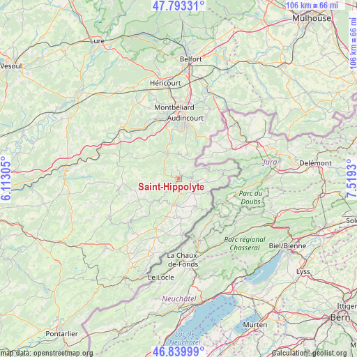
Saint-Hippolyte GPS coordinates[2]
47° 19' 7.68" North, 6° 48' 58.212" East
| Map corner | latitude | longitude |
|---|---|---|
| Upper-left | 47.79331°, | 6.11305° |
| Center: | 47.3188°, | 6.81617° |
| Lower-right: | 46.83999°, | 7.5193° |
| Map W x H: | 106×106 km | = 65.9×65.9mi |
| max Lat: | 51.07786° ⇑51.2% North |
| Saint-Hippolyte: | 47.3188° |
| min Lat: | ⇓48.8% South 41.3874° |
| min Long | Saint-Hippolyte | max Long |
| -5.08615° | 6.81617° | 9.52242° |
| W 93.7%⇐ | ⇒6.3% E |
Elevation
Elevation of Saint-Hippolyte is 377 m = 1237 ft, and this is 183.3 m = 601 ft above average elevation for this country.
| Max E: |
2333 m = 7654 ft | 12.8% |
| Saint-Hippolyte | 377 m 1237 ft | |
| Avg. | 193.7 m = 635 ft | |
Min E: |
-1 m = -3 ft | 87.2% |
See also: France elevation on elevation.city.
Geographical zone
Saint-Hippolyte is located in North temperate zone (between Tropic of Cancer and the Arctic Circle). Distance of this North polar circle is 2139.8 km =1329.6 mi to North.| Distance of | km | miles | from Saint-Hippolyte |
|---|---|---|---|
| North Pole | 4745.7 | 2948.8 | to North |
| Arctic Circle | 2139.8 | 1329.6 | to North |
| Tropic Cancer | 2655.4 | 1650 | to South |
| Equator | 5261.4 | 3269.3 | to South |


Nearby cities:
15 places around Saint-Hippolyte: (largest is in red/bold)
• Autechaux-Roide
8.1 km =5 mi,  358°
358°
• Belleherbe
13.3 km =8.3 mi,  243°
243°
• Blamont
7.8 km =4.8 mi,  18°
18°
• Bourguignon
11 km =6.8 mi,  345°
345°
• Charquemont
11.6 km =7.2 mi,  178°
178°
• Damprichard
9.6 km =6 mi,  149°
149°
• Frambouhans
11.8 km =7.3 mi,  199°
199°
• Les Fontenelles
14.5 km =9 mi, 203°
• Les Écorces
11.5 km =7.1 mi,  187°
187°
• Mandeure
14.5 km =9 mi, 357°
• Mathay
13.6 km =8.5 mi, 350°
• Maîche
7.5 km =4.7 mi, 187°
• Montécheroux
3.4 km =2.1 mi, 347°
• Pont-de-Roide
8.4 km =5.2 mi,  334°
334°
• Roches-lès-Blamont
10.3 km =6.4 mi,  14°
14°
Sources, notices
• [Note1] Compared only with cities in France existing in our database
• [Src1] Map data: © OpenStreetMap contributors (CC-BY-SA)
• [Src2] Other city data from geonames.org with taken over terms of usage.
• [Src3] Geographical zone / Annual Mean Temperature by Robert A. Rohde @ Wikipedia
