Saint-Sylvestre-sur-Lot geodata
Saint-Sylvestre-sur-Lot (Nouvelle-Aquitaine) is a populated place; located in France in Europe/Paris (GMT+2) time zone. With population of 2,181 people, there are 4402 cities with bigger population in this country. Compared to other cities in France, 84.3% of cities are located further ↑North; 70.5% of cities are located further →East and 75.8% of cities have higher elevation than Saint-Sylvestre-sur-Lot. Note1
Administrative division(s):
- Level 1: Nouvelle-Aquitaine
- Level 2: Département du Lot-et-Garonne
- Level 3: Arrondissement de Villeneuve-sur-Lot
- Level 4: Saint-Sylvestre-sur-Lot
Current local time in Saint-Sylvestre-sur-Lot:
05:07 PM, SaturdayDifference from your time zone: hours


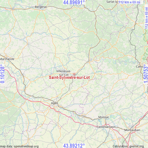
Saint-Sylvestre-sur-Lot GPS coordinates[2]
44° 23' 48.012" North, 0° 48' 15.876" East
| Map corner | latitude | longitude |
|---|---|---|
| Upper-left | 44.89691°, | 0.10128° |
| Center: | 44.39667°, | 0.80441° |
| Lower-right: | 43.89212°, | 1.50753° |
| Map W x H: | 111.7×111.7 km | = 69.4×69.4mi |
| max Lat: | 51.07786° ⇑84.3% North |
| Saint-Sylvestre-sur-Lot: | 44.39667° |
| min Lat: | ⇓15.7% South 41.3874° |
| min Long | Saint-Sylvestre | max Long |
| -5.08615° | 0.80441° | 9.52242° |
| W 29.5%⇐ | ⇒70.5% E |
Elevation
Elevation of Saint-Sylvestre-sur-Lot is 65 m = 213 ft, and this is 128.7 m = 422 ft below average elevation for this country.
| Max E: |
2333 m = 7654 ft | 75.8% |
| Avg. | 193.7 m = 635 ft | |
| Saint-Sylvestre-sur-Lot | 65 m = 213 ft | |
Min E: |
-1 m = -3 ft | 24.2% |
See also: France elevation on elevation.city.
Geographical zone
Saint-Sylvestre-sur-Lot is located in North temperate zone (between Tropic of Cancer and the Arctic Circle). Distance of this Northern Tropic circle is 2330.5 km =1448.1 mi to South.| Distance of | km | miles | from Saint-Sylvestre-sur-Lot |
|---|---|---|---|
| North Pole | 5070.6 | 3150.7 | to North |
| Arctic Circle | 2464.7 | 1531.5 | to North |
| Tropic Cancer | 2330.5 | 1448.1 | to South |
| Equator | 4936.4 | 3067.3 | to South |


Nearby cities:
15 places around Saint-Sylvestre-sur-Lot: (largest is in red/bold)
• Allez-et-Cazeneuve
14.9 km =9.3 mi,  271°
271°
• Beauville
14.6 km =9.1 mi,  154°
154°
• Bias
10.9 km =6.8 mi,  281°
281°
• Condezaygues
13.2 km =8.2 mi,  41°
41°
• Hautefage-la-Tour
8.3 km =5.2 mi,  191°
191°
• La Croix-Blanche
14.4 km =8.9 mi,  217°
217°
• Laroque-Timbaut
13.1 km =8.1 mi, 194°
• Lédat
12.4 km =7.7 mi,  300°
300°
• Monsempron-Libos
15 km =9.3 mi,  46°
46°
• Pujols
9.2 km =5.7 mi, 268°
• Saint-Antoine-de-Ficalba
9.9 km =6.2 mi, 223°
• Saint-Georges
11.4 km =7.1 mi,  64°
64°
• Saint-Vite
13.5 km =8.4 mi, 52°
• Trentels
6.2 km =3.9 mi, 47°
• Villeneuve-sur-Lot
8.1 km =5 mi, 279°
Sources, notices
• [Note1] Compared only with cities in France existing in our database
• [Src1] Map data: © OpenStreetMap contributors (CC-BY-SA)
• [Src2] Other city data from geonames.org with taken over terms of usage.
• [Src3] Geographical zone / Annual Mean Temperature by Robert A. Rohde @ Wikipedia
