Pujols geodata
Pujols (Nouvelle-Aquitaine) is a populated place; located in France in Europe/Paris (GMT+2) time zone. With population of 3,966 people, there are 2482 cities with bigger population in this country. Compared to other cities in France, 84.3% of cities are located further ↑North; 71.5% of cities are located further →East and 74.6% of cities have higher elevation than Pujols. Note1
Administrative division(s):
- Level 1: Nouvelle-Aquitaine
- Level 2: Département du Lot-et-Garonne
- Level 3: Arrondissement de Villeneuve-sur-Lot
- Level 4: Pujols


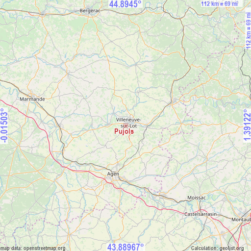
Pujols GPS coordinates[2]
44° 23' 39.264" North, 0° 41' 17.16" East
| Map corner | latitude | longitude |
|---|---|---|
| Upper-left | 44.8945°, | -0.01503° |
| Center: | 44.39424°, | 0.6881° |
| Lower-right: | 43.88967°, | 1.39122° |
| Map W x H: | 111.7×111.7 km | = 69.4×69.4mi |
| max Lat: | 51.07786° ⇑84.3% North |
| Pujols: | 44.39424° |
| min Lat: | ⇓15.7% South 41.3874° |
| min Long | Pujols | max Long |
| -5.08615° | 0.6881° | 9.52242° |
| W 28.5%⇐ | ⇒71.5% E |
Elevation
Elevation of Pujols is 68 m = 223 ft, and this is 125.7 m = 412 ft below average elevation for this country.
| Max E: |
2333 m = 7654 ft | 74.6% |
| Avg. | 193.7 m = 635 ft | |
| Pujols | 68 m = 223 ft | |
Min E: |
-1 m = -3 ft | 25.4% |
See also: France elevation on elevation.city.
Geographical zone
Pujols is located in North temperate zone (between Tropic of Cancer and the Arctic Circle). Distance of this Northern Tropic circle is 2330.3 km =1448 mi to South.| Distance of | km | miles | from Pujols |
|---|---|---|---|
| North Pole | 5070.9 | 3150.9 | to North |
| Arctic Circle | 2465 | 1531.7 | to North |
| Tropic Cancer | 2330.3 | 1448 | to South |
| Equator | 4936.2 | 3067.2 | to South |


Nearby cities:
15 places around Pujols: (largest is in red/bold)
• Allez-et-Cazeneuve
5.7 km =3.5 mi,  276°
276°
• Bias
2.9 km =1.8 mi,  329°
329°
• Casseneuil
7.6 km =4.7 mi,  315°
315°
• Castelnaud-de-Gratecambe
11.5 km =7.1 mi,  351°
351°
• Dolmayrac
8.7 km =5.4 mi,  245°
245°
• Hautefage-la-Tour
11 km =6.8 mi,  135°
135°
• La Croix-Blanche
11.1 km =6.9 mi,  177°
177°
• Laugnac
11.7 km =7.3 mi,  213°
213°
• Lédat
6.7 km =4.2 mi, 347°
• Pinel-Hauterive
9.4 km =5.8 mi,  295°
295°
• Saint-Antoine-de-Ficalba
7.3 km =4.5 mi,  160°
160°
• Saint-Sylvestre-sur-Lot
9.2 km =5.7 mi,  88°
88°
• Saint-Étienne-de-Fougères
10.9 km =6.8 mi, 284°
• Sainte-Livrade-sur-Lot
7.7 km =4.8 mi,  274°
274°
• Villeneuve-sur-Lot
2 km =1.2 mi,  38°
38°
Sources, notices
• [Note1] Compared only with cities in France existing in our database
• [Src1] Map data: © OpenStreetMap contributors (CC-BY-SA)
• [Src2] Other city data from geonames.org with taken over terms of usage.
• [Src3] Geographical zone / Annual Mean Temperature by Robert A. Rohde @ Wikipedia
