Saint-Priest-Ligoure geodata
Saint-Priest-Ligoure (Nouvelle-Aquitaine) is a populated place; located in France in Europe/Paris (GMT+2) time zone. With population of 583 people, there are 13590 cities with bigger population in this country. Compared to other cities in France, 71.7% of cities are located further ↑North; 65.7% of cities are located further →East and 80.5% of cities have lower elevation than Saint-Priest-Ligoure. Note1
Administrative division(s):
- Level 1: Nouvelle-Aquitaine
- Level 2: Haute-Vienne
- Level 3: Arrondissement de Limoges
- Level 4: Saint-Priest-Ligoure


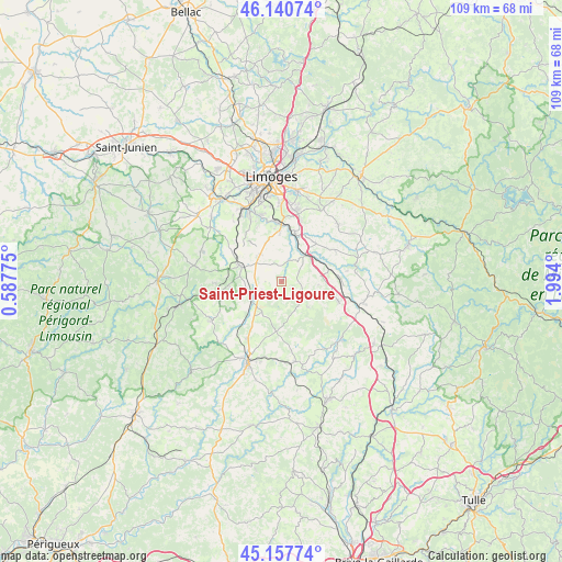
Saint-Priest-Ligoure GPS coordinates[2]
45° 39' 5.04" North, 1° 17' 27.168" East
| Map corner | latitude | longitude |
|---|---|---|
| Upper-left | 46.14074°, | 0.58775° |
| Center: | 45.6514°, | 1.29088° |
| Lower-right: | 45.15774°, | 1.994° |
| Map W x H: | 109.3×109.3 km | = 67.9×67.9mi |
| max Lat: | 51.07786° ⇑71.7% North |
| Saint-Priest-Ligoure: | 45.6514° |
| min Lat: | ⇓28.3% South 41.3874° |
| min Long | Saint-Priest-Li | max Long |
| -5.08615° | 1.29088° | 9.52242° |
| W 34.3%⇐ | ⇒65.7% E |
Elevation
Elevation of Saint-Priest-Ligoure is 296 m = 971 ft, and this is 102.3 m = 336 ft above average elevation for this country.
| Max E: |
2333 m = 7654 ft | 19.5% |
| Saint-Priest-Ligoure | 296 m 971 ft | |
| Avg. | 193.7 m = 635 ft | |
Min E: |
-1 m = -3 ft | 80.5% |
See also: France elevation on elevation.city.
Geographical zone
Saint-Priest-Ligoure is located in North temperate zone (between Tropic of Cancer and the Arctic Circle). Distance of this North polar circle is 2325.2 km =1444.8 mi to North.| Distance of | km | miles | from Saint-Priest-Ligoure |
|---|---|---|---|
| North Pole | 4931.1 | 3064 | to North |
| Arctic Circle | 2325.2 | 1444.8 | to North |
| Tropic Cancer | 2470 | 1534.8 | to South |
| Equator | 5076 | 3154.1 | to South |


Nearby cities:
15 places around Saint-Priest-Ligoure: (largest is in red/bold)
• Boisseuil
13.6 km =8.5 mi,  13°
13°
• Bosmie-l'Aiguille
13 km =8.1 mi,  327°
327°
• Burgnac
13.7 km =8.5 mi,  307°
307°
• Château-Chervix
6.9 km =4.3 mi,  135°
135°
• Jourgnac
9.6 km =6 mi,  321°
321°
• La Meyze
7.1 km =4.4 mi,  237°
237°
• Le Vigen
11.2 km =7 mi,  359°
359°
• Magnac-Bourg
11.5 km =7.1 mi,  108°
108°
• Nexon
8.8 km =5.5 mi,  291°
291°
• Pierre-Buffière
7.1 km =4.4 mi,  47°
47°
• Saint-Hilaire-Bonneval
10 km =6.2 mi,  40°
40°
• Saint-Hilaire-les-Places
10.3 km =6.4 mi,  266°
266°
• Saint-Maurice-les-Brousses
6.9 km =4.3 mi, 321°
• Solignac
11.6 km =7.2 mi,  353°
353°
• Vicq-sur-Breuilh
7.1 km =4.4 mi,  94°
94°
Sources, notices
• [Note1] Compared only with cities in France existing in our database
• [Src1] Map data: © OpenStreetMap contributors (CC-BY-SA)
• [Src2] Other city data from geonames.org with taken over terms of usage.
• [Src3] Geographical zone / Annual Mean Temperature by Robert A. Rohde @ Wikipedia
