Saint-Hilaire-les-Places geodata
Saint-Hilaire-les-Places (Nouvelle-Aquitaine) is a populated place; located in France in Europe/Paris (GMT+2) time zone. With population of 811 people, there are 10468 cities with bigger population in this country. Compared to other cities in France, 71.8% of cities are located further ↑North; 67.3% of cities are located further →East and 88.6% of cities have lower elevation than Saint-Hilaire-les-Places. Note1
Administrative division(s):
- Level 1: Nouvelle-Aquitaine
- Level 2: Haute-Vienne
- Level 3: Arrondissement de Limoges
- Level 4: Saint-Hilaire-les-Places
Current local time in Saint-Hilaire-les-Places:
10:45 AM, SaturdayDifference from your time zone: hours


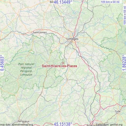
Saint-Hilaire-les-Places GPS coordinates[2]
45° 38' 42.324" North, 1° 9' 32.976" East
| Map corner | latitude | longitude |
|---|---|---|
| Upper-left | 46.13449°, | 0.45603° |
| Center: | 45.64509°, | 1.15916° |
| Lower-right: | 45.15138°, | 1.86228° |
| Map W x H: | 109.3×109.3 km | = 67.9×67.9mi |
| max Lat: | 51.07786° ⇑71.8% North |
| Saint-Hilaire-les-Places: | 45.64509° |
| min Lat: | ⇓28.2% South 41.3874° |
| min Long | Saint-Hilaire-l | max Long |
| -5.08615° | 1.15916° | 9.52242° |
| W 32.7%⇐ | ⇒67.3% E |
Elevation
Elevation of Saint-Hilaire-les-Places is 400 m = 1312 ft, and this is 206.3 m = 677 ft above average elevation for this country.
| Max E: |
2333 m = 7654 ft | 11.4% |
| Saint-Hilaire-les-Places | 400 m 1312 ft | |
| Avg. | 193.7 m = 635 ft | |
Min E: |
-1 m = -3 ft | 88.6% |
See also: France elevation on elevation.city.
Geographical zone
Saint-Hilaire-les-Places is located in North temperate zone (between Tropic of Cancer and the Arctic Circle). Distance of this North polar circle is 2325.9 km =1445.2 mi to North.| Distance of | km | miles | from Saint-Hilaire-les-Places |
|---|---|---|---|
| North Pole | 4931.8 | 3064.5 | to North |
| Arctic Circle | 2325.9 | 1445.2 | to North |
| Tropic Cancer | 2469.3 | 1534.4 | to South |
| Equator | 5075.3 | 3153.6 | to South |


Nearby cities:
15 places around Saint-Hilaire-les-Places: (largest is in red/bold)
• Beynac
13.6 km =8.5 mi,  2°
2°
• Bosmie-l'Aiguille
12.1 km =7.5 mi,  15°
15°
• Burgnac
9 km =5.6 mi,  356°
356°
• Bussière-Galant
9.8 km =6.1 mi,  258°
258°
• Châlus
13.9 km =8.6 mi,  274°
274°
• Flavignac
8.4 km =5.2 mi,  321°
321°
• Jourgnac
9.3 km =5.8 mi,  27°
27°
• La Meyze
5.3 km =3.3 mi,  126°
126°
• Ladignac-le-Long
7.8 km =4.8 mi,  207°
207°
• Les Cars
7.8 km =4.8 mi,  300°
300°
• Nexon
4.4 km =2.7 mi, 27°
• Pageas
12.9 km =8 mi,  286°
286°
• Saint-Martin-le-Vieux
11.5 km =7.1 mi,  344°
344°
• Saint-Maurice-les-Brousses
8.5 km =5.3 mi,  44°
44°
• Saint-Priest-Ligoure
10.3 km =6.4 mi,  86°
86°
Sources, notices
• [Note1] Compared only with cities in France existing in our database
• [Src1] Map data: © OpenStreetMap contributors (CC-BY-SA)
• [Src2] Other city data from geonames.org with taken over terms of usage.
• [Src3] Geographical zone / Annual Mean Temperature by Robert A. Rohde @ Wikipedia
