Saint-Paul geodata
Saint-Paul (Hauts-de-France) is a populated place; located in France in Europe/Paris (GMT+2) time zone. With population of 1,509 people, there are 6162 cities with bigger population in this country. Compared to other cities in France, 88.3% of cities are located further ↓South; 57% of cities are located further →East and 57.3% of cities have higher elevation than Saint-Paul. Note1
Administrative division(s):
- Level 1: Hauts-de-France
- Level 2: Département de l'Oise
- Level 3: Arrondissement de Beauvais
- Level 4: Saint-Paul


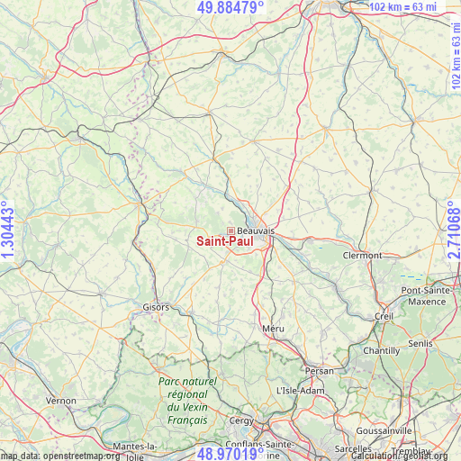
Saint-Paul GPS coordinates[2]
49° 25' 46.632" North, 2° 0' 27.18" East
| Map corner | latitude | longitude |
|---|---|---|
| Upper-left | 49.88479°, | 1.30443° |
| Center: | 49.42962°, | 2.00755° |
| Lower-right: | 48.97019°, | 2.71068° |
| Map W x H: | 101.7×101.7 km | = 63.2×63.2mi |
| max Lat: | 51.07786° ⇑11.7% North |
| Saint-Paul: | 49.42962° |
| min Lat: | ⇓88.3% South 41.3874° |
| min Long | Saint-Paul | max Long |
| -5.08615° | 2.00755° | 9.52242° |
| W 43%⇐ | ⇒57% E |
Elevation
Elevation of Saint-Paul is 110 m = 361 ft, and this is 83.7 m = 275 ft below average elevation for this country.
| Max E: |
2333 m = 7654 ft | 57.3% |
| Avg. | 193.7 m = 635 ft | |
| Saint-Paul | 110 m = 361 ft | |
Min E: |
-1 m = -3 ft | 42.7% |
See also: France elevation on elevation.city.
Geographical zone
Saint-Paul is located in North temperate zone (between Tropic of Cancer and the Arctic Circle). Distance of this North polar circle is 1905.1 km =1183.8 mi to North.| Distance of | km | miles | from Saint-Paul |
|---|---|---|---|
| North Pole | 4511 | 2803 | to North |
| Arctic Circle | 1905.1 | 1183.8 | to North |
| Tropic Cancer | 2890.1 | 1795.8 | to South |
| Equator | 5496.1 | 3415.1 | to South |


Nearby cities:
15 places around Saint-Paul: (largest is in red/bold)
• Allonne
8.1 km =5 mi,  106°
106°
• Auneuil
6.6 km =4.1 mi,  186°
186°
• Aux Marais
3 km =1.9 mi,  123°
123°
• Beauvais
5.5 km =3.4 mi,  85°
85°
• Frocourt
7.6 km =4.7 mi,  133°
133°
• Goincourt
2.1 km =1.3 mi,  100°
100°
• Herchies
6.5 km =4 mi,  1°
1°
• Lachapelle-aux-Pots
7.9 km =4.9 mi,  285°
285°
• Le Mont-Saint-Adrien
1.8 km =1.1 mi,  353°
353°
• Ons-en-Bray
6.3 km =3.9 mi,  256°
256°
• Rainvillers
2.7 km =1.7 mi,  179°
179°
• Saint-Martin-le-Nœud
5.3 km =3.3 mi, 133°
• Savignies
5 km =3.1 mi,  322°
322°
• Troissereux
6.2 km =3.9 mi,  25°
25°
• Villers-Saint-Barthélemy
5.5 km =3.4 mi,  229°
229°
Sources, notices
• [Note1] Compared only with cities in France existing in our database
• [Src1] Map data: © OpenStreetMap contributors (CC-BY-SA)
• [Src2] Other city data from geonames.org with taken over terms of usage.
• [Src3] Geographical zone / Annual Mean Temperature by Robert A. Rohde @ Wikipedia
