Lachapelle-aux-Pots geodata
Lachapelle-aux-Pots (Hauts-de-France) is a populated place; located in France in Europe/Paris (GMT+2) time zone. With population of 1,614 people, there are 5787 cities with bigger population in this country. Compared to other cities in France, 88.6% of cities are located further ↓South; 58.2% of cities are located further →East and 57.3% of cities have higher elevation than Lachapelle-aux-Pots. Note1
Administrative division(s):
- Level 1: Hauts-de-France
- Level 2: Département de l'Oise
- Level 3: Arrondissement de Beauvais
- Level 4: Lachapelle-aux-Pots


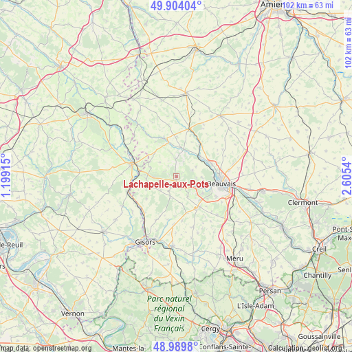
Lachapelle-aux-Pots GPS coordinates[2]
49° 26' 56.58" North, 1° 54' 8.208" East
| Map corner | latitude | longitude |
|---|---|---|
| Upper-left | 49.90404°, | 1.19915° |
| Center: | 49.44905°, | 1.90228° |
| Lower-right: | 48.9898°, | 2.6054° |
| Map W x H: | 101.7×101.7 km | = 63.2×63.2mi |
| max Lat: | 51.07786° ⇑11.4% North |
| Lachapelle-aux-Pots: | 49.44905° |
| min Lat: | ⇓88.6% South 41.3874° |
| min Long | Lachapelle-aux- | max Long |
| -5.08615° | 1.90228° | 9.52242° |
| W 41.8%⇐ | ⇒58.2% E |
Elevation
Elevation of Lachapelle-aux-Pots is 110 m = 361 ft, and this is 83.7 m = 275 ft below average elevation for this country.
| Max E: |
2333 m = 7654 ft | 57.3% |
| Avg. | 193.7 m = 635 ft | |
| Lachapelle-aux-Pots | 110 m = 361 ft | |
Min E: |
-1 m = -3 ft | 42.7% |
See also: France elevation on elevation.city.
Geographical zone
Lachapelle-aux-Pots is located in North temperate zone (between Tropic of Cancer and the Arctic Circle). Distance of this North polar circle is 1903 km =1182.5 mi to North.| Distance of | km | miles | from Lachapelle-aux-Pots |
|---|---|---|---|
| North Pole | 4508.8 | 2801.6 | to North |
| Arctic Circle | 1903 | 1182.5 | to North |
| Tropic Cancer | 2892.3 | 1797.2 | to South |
| Equator | 5498.2 | 3416.4 | to South |


Nearby cities:
15 places around Lachapelle-aux-Pots: (largest is in red/bold)
• Cuigy-en-Bray
6 km =3.7 mi,  245°
245°
• Hanvoile
7 km =4.3 mi,  347°
347°
• Herchies
8.9 km =5.5 mi,  60°
60°
• Le Coudray-Saint-Germer
6.2 km =3.9 mi,  228°
228°
• Le Mont-Saint-Adrien
7.4 km =4.6 mi,  92°
92°
• Le Vauroux
7.9 km =4.9 mi,  168°
168°
• Milly-sur-Thérain
9 km =5.6 mi,  48°
48°
• Ons-en-Bray
3.9 km =2.4 mi,  157°
157°
• Rainvillers
9 km =5.6 mi,  122°
122°
• Saint-Aubin-en-Bray
3.6 km =2.2 mi,  209°
209°
• Saint-Germer-de-Fly
8.9 km =5.5 mi,  265°
265°
• Saint-Paul
7.9 km =4.9 mi,  105°
105°
• Savignies
4.9 km =3 mi,  68°
68°
• Senantes
6.4 km =4 mi,  310°
310°
• Villers-Saint-Barthélemy
6.7 km =4.2 mi,  149°
149°
Sources, notices
• [Note1] Compared only with cities in France existing in our database
• [Src1] Map data: © OpenStreetMap contributors (CC-BY-SA)
• [Src2] Other city data from geonames.org with taken over terms of usage.
• [Src3] Geographical zone / Annual Mean Temperature by Robert A. Rohde @ Wikipedia
