Saint-Michel-sur-Orge geodata
Saint-Michel-sur-Orge (Île-de-France) is a populated place; located in France in Europe/Paris (GMT+2) time zone. With population of 20,824 people, there are 438 cities with bigger population in this country. Compared to other cities in France, 71.7% of cities are located further ↓South; 52.6% of cities are located further →East and 75.4% of cities have higher elevation than Saint-Michel-sur-Orge. Note1
Administrative division(s):
- Level 1: Île-de-France
- Level 2: Département de l'Essonne
- Level 3: Arrondissement de Palaiseau
- Level 4: Saint-Michel-sur-Orge
Current local time in Saint-Michel-sur-Orge:
01:41 AM, SaturdayDifference from your time zone: hours


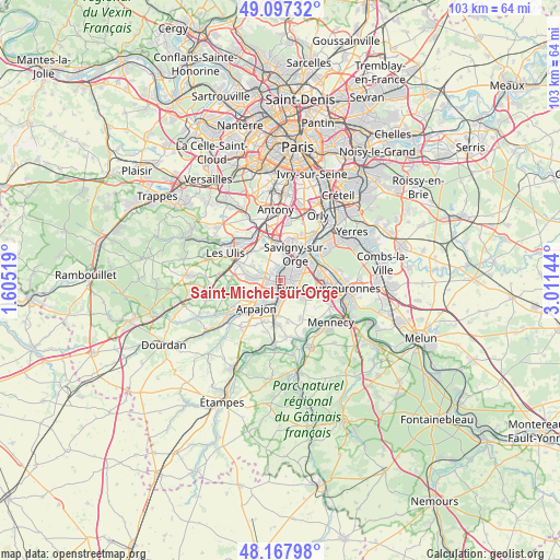
Saint-Michel-sur-Orge GPS coordinates[2]
48° 38' 5.244" North, 2° 18' 29.916" East
| Map corner | latitude | longitude |
|---|---|---|
| Upper-left | 49.09732°, | 1.60519° |
| Center: | 48.63479°, | 2.30831° |
| Lower-right: | 48.16798°, | 3.01144° |
| Map W x H: | 103.3×103.3 km | = 64.2×64.2mi |
| max Lat: | 51.07786° ⇑28.3% North |
| Saint-Michel-sur-Orge: | 48.63479° |
| min Lat: | ⇓71.7% South 41.3874° |
| min Long | Saint-Michel-su | max Long |
| -5.08615° | 2.30831° | 9.52242° |
| W 47.4%⇐ | ⇒52.6% E |
Elevation
Elevation of Saint-Michel-sur-Orge is 66 m = 217 ft, and this is 127.7 m = 419 ft below average elevation for this country.
| Max E: |
2333 m = 7654 ft | 75.4% |
| Avg. | 193.7 m = 635 ft | |
| Saint-Michel-sur-Orge | 66 m = 217 ft | |
Min E: |
-1 m = -3 ft | 24.6% |
See also: France elevation on elevation.city.
Geographical zone
Saint-Michel-sur-Orge is located in North temperate zone (between Tropic of Cancer and the Arctic Circle). Distance of this North polar circle is 1993.5 km =1238.7 mi to North.| Distance of | km | miles | from Saint-Michel-sur-Orge |
|---|---|---|---|
| North Pole | 4599.4 | 2857.9 | to North |
| Arctic Circle | 1993.5 | 1238.7 | to North |
| Tropic Cancer | 2801.8 | 1741 | to South |
| Equator | 5407.7 | 3360.2 | to South |


Nearby cities:
15 places around Saint-Michel-sur-Orge: (largest is in red/bold)
• Ballainvilliers
4.5 km =2.8 mi,  352°
352°
• Brétigny-sur-Orge
2.6 km =1.6 mi,  183°
183°
• Fleury-Mérogis
4.1 km =2.5 mi,  86°
86°
• La Ville-du-Bois
3.7 km =2.3 mi,  307°
307°
• Le Plessis-Pâté
2.9 km =1.8 mi,  157°
157°
• Leuville-sur-Orge
3.6 km =2.2 mi,  237°
237°
• Linas
3.4 km =2.1 mi,  261°
261°
• Longpont-sur-Orge
1.4 km =0.9 mi,  303°
303°
• Marcoussis
5.2 km =3.2 mi,  276°
276°
• Montlhéry
2.5 km =1.6 mi, 283°
• Morsang-sur-Orge
4.5 km =2.8 mi,  47°
47°
• Sainte-Geneviève-des-Bois
1.6 km =1 mi,  31°
31°
• Villemoisson-sur-Orge
4.1 km =2.5 mi, 30°
• Villiers-sur-Orge
2.8 km =1.7 mi, 347°
• Épinay-sur-Orge
4.3 km =2.7 mi,  2°
2°
Sources, notices
• [Note1] Compared only with cities in France existing in our database
• [Src1] Map data: © OpenStreetMap contributors (CC-BY-SA)
• [Src2] Other city data from geonames.org with taken over terms of usage.
• [Src3] Geographical zone / Annual Mean Temperature by Robert A. Rohde @ Wikipedia
