Saint-Martin-la-Garenne geodata
Saint-Martin-la-Garenne (Île-de-France) is a populated place; located in France in Europe/Paris (GMT+2) time zone. With population of 807 people, there are 10522 cities with bigger population in this country. Compared to other cities in France, 80.6% of cities are located further ↓South; 60.6% of cities are located further →East and 79% of cities have higher elevation than Saint-Martin-la-Garenne. Note1
Administrative division(s):
- Level 1: Île-de-France
- Level 2: Yvelines
- Level 3: Arrondissement de Mantes-la-Jolie
- Level 4: Saint-Martin-la-Garenne
Current local time in Saint-Martin-la-Garenne:
11:17 AM, SaturdayDifference from your time zone: hours


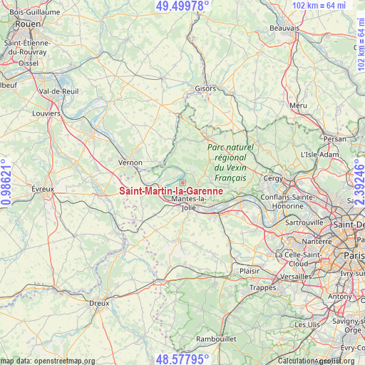
Saint-Martin-la-Garenne GPS coordinates[2]
49° 2' 27.6" North, 1° 41' 21.624" East
| Map corner | latitude | longitude |
|---|---|---|
| Upper-left | 49.49978°, | 0.98621° |
| Center: | 49.041°, | 1.68934° |
| Lower-right: | 48.57795°, | 2.39246° |
| Map W x H: | 102.5×102.5 km | = 63.7×63.7mi |
| max Lat: | 51.07786° ⇑19.4% North |
| Saint-Martin-la-Garenne: | 49.041° |
| min Lat: | ⇓80.6% South 41.3874° |
| min Long | Saint-Martin-la | max Long |
| -5.08615° | 1.68934° | 9.52242° |
| W 39.4%⇐ | ⇒60.6% E |
Elevation
Elevation of Saint-Martin-la-Garenne is 57 m = 187 ft, and this is 136.7 m = 448 ft below average elevation for this country.
| Max E: |
2333 m = 7654 ft | 79% |
| Avg. | 193.7 m = 635 ft | |
| Saint-Martin-la-Garenne | 57 m = 187 ft | |
Min E: |
-1 m = -3 ft | 21% |
See also: France elevation on elevation.city.
Geographical zone
Saint-Martin-la-Garenne is located in North temperate zone (between Tropic of Cancer and the Arctic Circle). Distance of this North polar circle is 1948.3 km =1210.6 mi to North.| Distance of | km | miles | from Saint-Martin-la-Garenne |
|---|---|---|---|
| North Pole | 4554.2 | 2829.8 | to North |
| Arctic Circle | 1948.3 | 1210.6 | to North |
| Tropic Cancer | 2846.9 | 1769 | to South |
| Equator | 5452.8 | 3388.2 | to South |


Nearby cities:
15 places around Saint-Martin-la-Garenne: (largest is in red/bold)
• Aincourt
7 km =4.3 mi,  60°
60°
• Buchelay
7 km =4.3 mi,  191°
191°
• Follainville-Dennemont
2.7 km =1.7 mi,  140°
140°
• Fontenay-Saint-Père
5.3 km =3.3 mi,  109°
109°
• Freneuse
6.4 km =4 mi,  277°
277°
• Guernes
5.1 km =3.2 mi,  229°
229°
• Guitrancourt
7.3 km =4.5 mi,  118°
118°
• La Roche-Guyon
6.2 km =3.9 mi,  316°
316°
• Limay
6.3 km =3.9 mi, 143°
• Mantes-la-Jolie
6 km =3.7 mi,  160°
160°
• Mantes-la-Ville
7.5 km =4.7 mi,  172°
172°
• Moisson
3.9 km =2.4 mi,  337°
337°
• Mousseaux-sur-Seine
3.1 km =1.9 mi, 276°
• Rosny-sur-Seine
6.4 km =4 mi,  221°
221°
• Vétheuil
2.6 km =1.6 mi,  23°
23°
Sources, notices
• [Note1] Compared only with cities in France existing in our database
• [Src1] Map data: © OpenStreetMap contributors (CC-BY-SA)
• [Src2] Other city data from geonames.org with taken over terms of usage.
• [Src3] Geographical zone / Annual Mean Temperature by Robert A. Rohde @ Wikipedia
