Saint-Martin-de-Sanzay geodata
Saint-Martin-de-Sanzay (Nouvelle-Aquitaine) is a populated place; located in France in Europe/Paris (GMT+2) time zone. With population of 904 people, there are 9617 cities with bigger population in this country. Compared to other cities in France, 54.4% of cities are located further ↑North; 79.6% of cities are located further →East and 86.2% of cities have higher elevation than Saint-Martin-de-Sanzay. Note1
Administrative division(s):
- Level 1: Nouvelle-Aquitaine
- Level 2: Département des Deux-Sèvres
- Level 3: Arrondissement de Bressuire
- Level 4: Saint-Martin-de-Sanzay
Current local time in Saint-Martin-de-Sanzay:
09:58 AM, SaturdayDifference from your time zone: hours


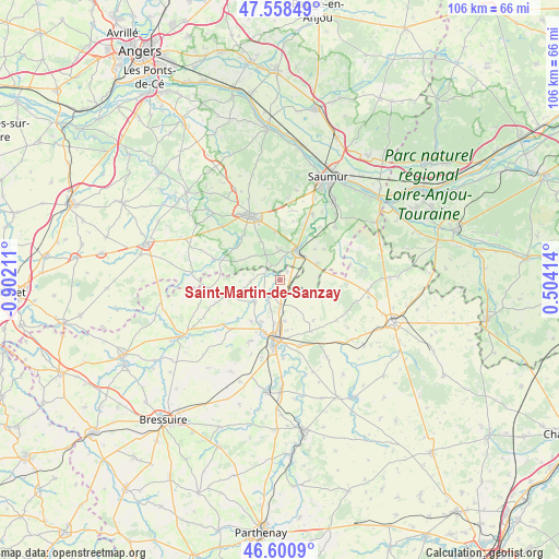
Saint-Martin-de-Sanzay GPS coordinates[2]
47° 4' 54.66" North, 0° 11' 56.328" West
| Map corner | latitude | longitude |
|---|---|---|
| Upper-left | 47.55849°, | -0.90211° |
| Center: | 47.08185°, | -0.19898° |
| Lower-right: | 46.6009°, | 0.50414° |
| Map W x H: | 106.5×106.5 km | = 66.2×66.2mi |
| max Lat: | 51.07786° ⇑54.4% North |
| Saint-Martin-de-Sanzay: | 47.08185° |
| min Lat: | ⇓45.6% South 41.3874° |
| min Long | Saint-Martin-de | max Long |
| -5.08615° | -0.19898° | 9.52242° |
| W 20.4%⇐ | ⇒79.6% E |
Elevation
Elevation of Saint-Martin-de-Sanzay is 39 m = 128 ft, and this is 154.7 m = 508 ft below average elevation for this country.
| Max E: |
2333 m = 7654 ft | 86.2% |
| Avg. | 193.7 m = 635 ft | |
| Saint-Martin-de-Sanzay | 39 m = 128 ft | |
Min E: |
-1 m = -3 ft | 13.8% |
See also: France elevation on elevation.city.
Geographical zone
Saint-Martin-de-Sanzay is located in North temperate zone (between Tropic of Cancer and the Arctic Circle). Distance of this North polar circle is 2166.2 km =1346 mi to North.| Distance of | km | miles | from Saint-Martin-de-Sanzay |
|---|---|---|---|
| North Pole | 4772.1 | 2965.2 | to North |
| Arctic Circle | 2166.2 | 1346 | to North |
| Tropic Cancer | 2629.1 | 1633.6 | to South |
| Equator | 5235 | 3252.9 | to South |


Nearby cities:
15 places around Saint-Martin-de-Sanzay: (largest is in red/bold)
• Bouillé-Loretz
5.5 km =3.4 mi,  266°
266°
• Brion-près-Thouet
3.4 km =2.1 mi,  164°
164°
• Cersay
12.4 km =7.7 mi,  251°
251°
• Le Puy-Notre-Dame
5.6 km =3.5 mi,  330°
330°
• Les Verchers-sur-Layon
11 km =6.8 mi,  317°
317°
• Louzy
7.8 km =4.8 mi,  173°
173°
• Mauzé-Thouarsais
13.2 km =8.2 mi,  207°
207°
• Montreuil-Bellay
6.5 km =4 mi,  32°
32°
• Nueil-sur-Layon
13.2 km =8.2 mi,  287°
287°
• Saint-Jean-de-Thouars
13.1 km =8.1 mi,  184°
184°
• Saint-Léger-de-Montbrun
10.4 km =6.5 mi,  151°
151°
• Sainte-Radegonde
11.6 km =7.2 mi,  199°
199°
• Sainte-Verge
8.3 km =5.2 mi,  186°
186°
• Thouars
11.2 km =7 mi, 184°
• Vaudelnay
6.3 km =3.9 mi,  354°
354°
Sources, notices
• [Note1] Compared only with cities in France existing in our database
• [Src1] Map data: © OpenStreetMap contributors (CC-BY-SA)
• [Src2] Other city data from geonames.org with taken over terms of usage.
• [Src3] Geographical zone / Annual Mean Temperature by Robert A. Rohde @ Wikipedia
