Thouars geodata
Thouars (Nouvelle-Aquitaine) is a populated place; located in France in Europe/Paris (GMT+2) time zone. With population of 11,517 people, there are 838 cities with bigger population in this country. Compared to other cities in France, 55.5% of cities are located further ↑North; 79.8% of cities are located further →East and 63.2% of cities have higher elevation than Thouars. Note1
Administrative division(s):
- Level 1: Nouvelle-Aquitaine
- Level 2: Département des Deux-Sèvres
- Level 3: Arrondissement de Bressuire
- Level 4: Thouars


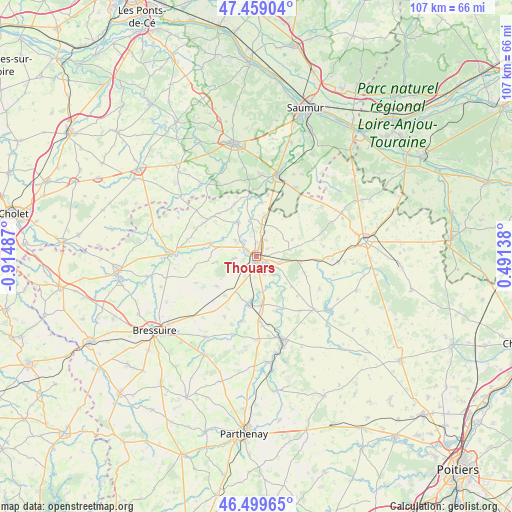
Thouars GPS coordinates[2]
46° 58' 53.4" North, 0° 12' 42.3" West
| Map corner | latitude | longitude |
|---|---|---|
| Upper-left | 47.45904°, | -0.91487° |
| Center: | 46.9815°, | -0.21175° |
| Lower-right: | 46.49965°, | 0.49138° |
| Map W x H: | 106.7×106.7 km | = 66.3×66.3mi |
| max Lat: | 51.07786° ⇑55.5% North |
| Thouars: | 46.9815° |
| min Lat: | ⇓44.5% South 41.3874° |
| min Long | Thouars | max Long |
| -5.08615° | -0.21175° | 9.52242° |
| W 20.2%⇐ | ⇒79.8% E |
Elevation
Elevation of Thouars is 94 m = 308 ft, and this is 99.7 m = 327 ft below average elevation for this country.
| Max E: |
2333 m = 7654 ft | 63.2% |
| Avg. | 193.7 m = 635 ft | |
| Thouars | 94 m = 308 ft | |
Min E: |
-1 m = -3 ft | 36.8% |
See also: France elevation on elevation.city.
Geographical zone
Thouars is located in North temperate zone (between Tropic of Cancer and the Arctic Circle). Distance of this North polar circle is 2177.3 km =1352.9 mi to North.| Distance of | km | miles | from Thouars |
|---|---|---|---|
| North Pole | 4783.2 | 2972.1 | to North |
| Arctic Circle | 2177.3 | 1352.9 | to North |
| Tropic Cancer | 2617.9 | 1626.7 | to South |
| Equator | 5223.9 | 3246 | to South |


Nearby cities:
15 places around Thouars: (largest is in red/bold)
• Bouillé-Loretz
11.8 km =7.3 mi,  337°
337°
• Brion-près-Thouet
8.1 km =5 mi,  13°
13°
• Louzy
3.9 km =2.4 mi,  29°
29°
• Luzay
6.6 km =4.1 mi,  168°
168°
• Massais
10.4 km =6.5 mi,  284°
284°
• Mauzé-Thouarsais
5.1 km =3.2 mi,  263°
263°
• Missé
4 km =2.5 mi,  158°
158°
• Oiron
10.4 km =6.5 mi,  108°
108°
• Saint-Jean-de-Thouars
2 km =1.2 mi,  179°
179°
• Saint-Léger-de-Montbrun
6.3 km =3.9 mi,  70°
70°
• Saint-Martin-de-Sanzay
11.2 km =7 mi,  4°
4°
• Saint-Varent
10.3 km =6.4 mi,  188°
188°
• Sainte-Radegonde
2.9 km =1.8 mi,  274°
274°
• Sainte-Verge
2.9 km =1.8 mi, 1°
• Taizé
9.6 km =6 mi,  130°
130°
Sources, notices
• [Note1] Compared only with cities in France existing in our database
• [Src1] Map data: © OpenStreetMap contributors (CC-BY-SA)
• [Src2] Other city data from geonames.org with taken over terms of usage.
• [Src3] Geographical zone / Annual Mean Temperature by Robert A. Rohde @ Wikipedia
