Saint-Laurent-de-Neste geodata
Saint-Laurent-de-Neste (Occitanie) is a populated place; located in France in Europe/Paris (GMT+2) time zone. With population of 905 people, there are 9610 cities with bigger population in this country. Compared to other cities in France, 98.2% of cities are located further ↑North; 73.5% of cities are located further →East and 91.9% of cities have lower elevation than Saint-Laurent-de-Neste. Note1
Administrative division(s):
- Level 1: Occitanie
- Level 2: Département des Hautes-Pyrénées
- Level 3: Arrondissement de Bagnères-de-Bigorre
- Level 4: Saint-Laurent-de-Neste
Current local time in Saint-Laurent-de-Neste:
07:54 PM, SaturdayDifference from your time zone: hours


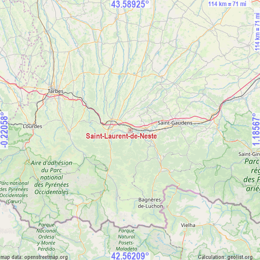
Saint-Laurent-de-Neste GPS coordinates[2]
43° 4' 40.152" North, 0° 28' 57.18" East
| Map corner | latitude | longitude |
|---|---|---|
| Upper-left | 43.58925°, | -0.22058° |
| Center: | 43.07782°, | 0.48255° |
| Lower-right: | 42.56209°, | 1.18567° |
| Map W x H: | 114.2×114.2 km | = 71×71mi |
| max Lat: | 51.07786° ⇑98.2% North |
| Saint-Laurent-de-Neste: | 43.07782° |
| min Lat: | ⇓1.8% South 41.3874° |
| min Long | Saint-Laurent-d | max Long |
| -5.08615° | 0.48255° | 9.52242° |
| W 26.5%⇐ | ⇒73.5% E |
Elevation
Elevation of Saint-Laurent-de-Neste is 473 m = 1552 ft, and this is 279.3 m = 916 ft above average elevation for this country.
| Max E: |
2333 m = 7654 ft | 8.1% |
| Saint-Laurent-de-Neste | 473 m 1552 ft | |
| Avg. | 193.7 m = 635 ft | |
Min E: |
-1 m = -3 ft | 91.9% |
See also: France elevation on elevation.city.
Geographical zone
Saint-Laurent-de-Neste is located in North temperate zone (between Tropic of Cancer and the Arctic Circle). Distance of this Northern Tropic circle is 2183.9 km =1357 mi to South.| Distance of | km | miles | from Saint-Laurent-de-Neste |
|---|---|---|---|
| North Pole | 5217.3 | 3241.9 | to North |
| Arctic Circle | 2611.4 | 1622.6 | to North |
| Tropic Cancer | 2183.9 | 1357 | to South |
| Equator | 4789.8 | 2976.2 | to South |


Nearby cities:
15 places around Saint-Laurent-de-Neste: (largest is in red/bold)
• Ausson
9.1 km =5.7 mi,  87°
87°
• Avezac-Prat-Lahitte
12.2 km =7.6 mi,  264°
264°
• Capvern
13.8 km =8.6 mi,  281°
281°
• Clarac
11.8 km =7.3 mi,  79°
79°
• Gourdan-Polignan
7.5 km =4.7 mi,  95°
95°
• Hèches
11.2 km =7 mi,  232°
232°
• La Barthe-de-Neste
8 km =5 mi,  272°
272°
• Labarthe-Rivière
15.3 km =9.5 mi, 88°
• Lannemezan
9.6 km =6 mi,  303°
303°
• Loures-Barousse
11.7 km =7.3 mi,  120°
120°
• Montréjeau
6.7 km =4.2 mi, 82°
• Pointis-de-Rivière
10.9 km =6.8 mi, 84°
• Ponlat-Taillebourg
10.2 km =6.3 mi,  69°
69°
• Sarrancolin
14.7 km =9.1 mi,  214°
214°
• Villeneuve-de-Rivière
15.7 km =9.8 mi, 69°
Sources, notices
• [Note1] Compared only with cities in France existing in our database
• [Src1] Map data: © OpenStreetMap contributors (CC-BY-SA)
• [Src2] Other city data from geonames.org with taken over terms of usage.
• [Src3] Geographical zone / Annual Mean Temperature by Robert A. Rohde @ Wikipedia
