Lannemezan geodata
Lannemezan (Occitanie) is a populated place; located in France in Europe/Paris (GMT+2) time zone. With population of 6,606 people, there are 1495 cities with bigger population in this country. Compared to other cities in France, 97.8% of cities are located further ↑North; 74.5% of cities are located further →East and 95.1% of cities have lower elevation than Lannemezan. Note1
Administrative division(s):
- Level 1: Occitanie
- Level 2: Département des Hautes-Pyrénées
- Level 3: Arrondissement de Bagnères-de-Bigorre
- Level 4: Lannemezan


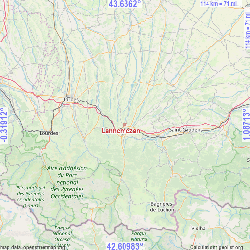
Lannemezan GPS coordinates[2]
43° 7' 30.612" North, 0° 23' 2.436" East
| Map corner | latitude | longitude |
|---|---|---|
| Upper-left | 43.6362°, | -0.31912° |
| Center: | 43.12517°, | 0.38401° |
| Lower-right: | 42.60983°, | 1.08713° |
| Map W x H: | 114.1×114.1 km | = 70.9×70.9mi |
| max Lat: | 51.07786° ⇑97.8% North |
| Lannemezan: | 43.12517° |
| min Lat: | ⇓2.2% South 41.3874° |
| min Long | Lannemezan | max Long |
| -5.08615° | 0.38401° | 9.52242° |
| W 25.5%⇐ | ⇒74.5% E |
Elevation
Elevation of Lannemezan is 594 m = 1949 ft, and this is 400.3 m = 1313 ft above average elevation for this country.
| Max E: |
2333 m = 7654 ft | 4.9% |
| Lannemezan | 594 m 1949 ft | |
| Avg. | 193.7 m = 635 ft | |
Min E: |
-1 m = -3 ft | 95.1% |
See also: France elevation on elevation.city.
Geographical zone
Lannemezan is located in North temperate zone (between Tropic of Cancer and the Arctic Circle). Distance of this Northern Tropic circle is 2189.2 km =1360.3 mi to South.| Distance of | km | miles | from Lannemezan |
|---|---|---|---|
| North Pole | 5212 | 3238.6 | to North |
| Arctic Circle | 2606.1 | 1619.4 | to North |
| Tropic Cancer | 2189.2 | 1360.3 | to South |
| Equator | 4795.1 | 2979.5 | to South |


Nearby cities:
15 places around Lannemezan: (largest is in red/bold)
• Ausson
17.8 km =11.1 mi,  105°
105°
• Avezac-Prat-Lahitte
7.7 km =4.8 mi,  212°
212°
• Bordes
15.4 km =9.6 mi,  302°
302°
• Capvern
6 km =3.7 mi,  246°
246°
• Cieutat
13.6 km =8.5 mi,  269°
269°
• Galan
11 km =6.8 mi,  9°
9°
• Gourdan-Polignan
16.6 km =10.3 mi, 111°
• Hèches
12.1 km =7.5 mi,  184°
184°
• La Barthe-de-Neste
4.9 km =3 mi, 179°
• Monléon-Magnoac
17.7 km =11 mi,  37°
37°
• Montréjeau
15.3 km =9.5 mi, 106°
• Ponlat-Taillebourg
17.6 km =10.9 mi,  95°
95°
• Saint-Laurent-de-Neste
9.6 km =6 mi,  123°
123°
• Sarrancolin
17.4 km =10.8 mi, 181°
• Tournay
13.1 km =8.1 mi, 300°
Sources, notices
• [Note1] Compared only with cities in France existing in our database
• [Src1] Map data: © OpenStreetMap contributors (CC-BY-SA)
• [Src2] Other city data from geonames.org with taken over terms of usage.
• [Src3] Geographical zone / Annual Mean Temperature by Robert A. Rohde @ Wikipedia
