Saint-Joseph geodata
Saint-Joseph (Normandy) is a populated place; located in France in Europe/Paris (GMT+2) time zone. With population of 753 people, there are 11137 cities with bigger population in this country. Compared to other cities in France, 89.8% of cities are located further ↓South; 92.5% of cities are located further →East and 65.6% of cities have higher elevation than Saint-Joseph. Note1
Administrative division(s):
- Level 1: Normandy
- Level 2: Manche
- Level 3: Arrondissement de Cherbourg
- Level 4: Saint-Joseph


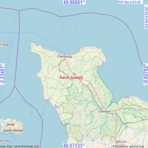
Saint-Joseph GPS coordinates[2]
49° 32' 1.716" North, 1° 31' 51.42" West
| Map corner | latitude | longitude |
|---|---|---|
| Upper-left | 49.98801°, | -2.23407° |
| Center: | 49.53381°, | -1.53095° |
| Lower-right: | 49.07535°, | -0.82782° |
| Map W x H: | 101.5×101.5 km | = 63.1×63.1mi |
| max Lat: | 51.07786° ⇑10.2% North |
| Saint-Joseph: | 49.53381° |
| min Lat: | ⇓89.8% South 41.3874° |
| min Long | Saint-Joseph | max Long |
| -5.08615° | -1.53095° | 9.52242° |
| W 7.5%⇐ | ⇒92.5% E |
Elevation
Elevation of Saint-Joseph is 88 m = 289 ft, and this is 105.7 m = 347 ft below average elevation for this country.
| Max E: |
2333 m = 7654 ft | 65.6% |
| Avg. | 193.7 m = 635 ft | |
| Saint-Joseph | 88 m = 289 ft | |
Min E: |
-1 m = -3 ft | 34.4% |
See also: France elevation on elevation.city.
Geographical zone
Saint-Joseph is located in North temperate zone (between Tropic of Cancer and the Arctic Circle). Distance of this North polar circle is 1893.5 km =1176.6 mi to North.| Distance of | km | miles | from Saint-Joseph |
|---|---|---|---|
| North Pole | 4499.4 | 2795.8 | to North |
| Arctic Circle | 1893.5 | 1176.6 | to North |
| Tropic Cancer | 2901.7 | 1803 | to South |
| Equator | 5507.6 | 3422.3 | to South |


Nearby cities:
15 places around Saint-Joseph: (largest is in red/bold)
• Bricquebec
10.2 km =6.3 mi,  225°
225°
• Brix
3.8 km =2.4 mi,  289°
289°
• Digosville
10.8 km =6.7 mi,  1°
1°
• Hardinvast
9.8 km =6.1 mi,  300°
300°
• La Glacerie
8.7 km =5.4 mi,  335°
335°
• Le Mesnil-au-Val
8 km =5 mi, 2°
• Le Theil
9.5 km =5.9 mi,  27°
27°
• Négreville
4.6 km =2.9 mi,  195°
195°
• Quettetot
11.1 km =6.9 mi,  242°
242°
• Rocheville
5.7 km =3.5 mi, 234°
• Saussemesnil
6.6 km =4.1 mi,  47°
47°
• Sottevast
4.5 km =2.8 mi,  255°
255°
• Tamerville
5.6 km =3.5 mi,  91°
91°
• Tollevast
8.3 km =5.2 mi, 302°
• Valognes
5.2 km =3.2 mi,  122°
122°
Sources, notices
• [Note1] Compared only with cities in France existing in our database
• [Src1] Map data: © OpenStreetMap contributors (CC-BY-SA)
• [Src2] Other city data from geonames.org with taken over terms of usage.
• [Src3] Geographical zone / Annual Mean Temperature by Robert A. Rohde @ Wikipedia
