Bricquebec geodata
Bricquebec (Normandy) is a populated place; located in France in Europe/Paris (GMT+2) time zone. With population of 4,475 people, there are 2204 cities with bigger population in this country. Compared to other cities in France, 88.8% of cities are located further ↓South; 93.2% of cities are located further →East and 83.1% of cities have higher elevation than Bricquebec. Note1
Administrative division(s):
- Level 1: Normandy
- Level 2: Manche
- Level 3: Arrondissement de Cherbourg
- Level 4: Bricquebec-en-Cotentin


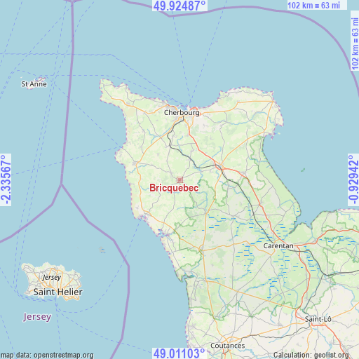
Bricquebec GPS coordinates[2]
49° 28' 12.288" North, 1° 37' 57.144" West
| Map corner | latitude | longitude |
|---|---|---|
| Upper-left | 49.92487°, | -2.33567° |
| Center: | 49.47008°, | -1.63254° |
| Lower-right: | 49.01103°, | -0.92942° |
| Map W x H: | 101.6×101.6 km | = 63.1×63.1mi |
| max Lat: | 51.07786° ⇑11.2% North |
| Bricquebec: | 49.47008° |
| min Lat: | ⇓88.8% South 41.3874° |
| min Long | Bricquebec | max Long |
| -5.08615° | -1.63254° | 9.52242° |
| W 6.8%⇐ | ⇒93.2% E |
Elevation
Elevation of Bricquebec is 47 m = 154 ft, and this is 146.7 m = 481 ft below average elevation for this country.
| Max E: |
2333 m = 7654 ft | 83.1% |
| Avg. | 193.7 m = 635 ft | |
| Bricquebec | 47 m = 154 ft | |
Min E: |
-1 m = -3 ft | 16.9% |
See also: France elevation on elevation.city.
Geographical zone
Bricquebec is located in North temperate zone (between Tropic of Cancer and the Arctic Circle). Distance of this North polar circle is 1900.6 km =1181 mi to North.| Distance of | km | miles | from Bricquebec |
|---|---|---|---|
| North Pole | 4506.5 | 2800.2 | to North |
| Arctic Circle | 1900.6 | 1181 | to North |
| Tropic Cancer | 2894.6 | 1798.6 | to South |
| Equator | 5500.6 | 3417.9 | to South |


Nearby cities:
15 places around Bricquebec: (largest is in red/bold)
• Besneville
11.4 km =7.1 mi,  178°
178°
• Brix
9.2 km =5.7 mi,  24°
24°
• Couville
9.9 km =6.2 mi,  337°
337°
• Grosville
9 km =5.6 mi,  298°
298°
• Le Vrétot
6 km =3.7 mi,  250°
250°
• Négreville
6.6 km =4.1 mi,  66°
66°
• Pierreville
10.7 km =6.6 mi,  272°
272°
• Quettetot
3.1 km =1.9 mi,  307°
307°
• Rauville-la-Bigot
6.6 km =4.1 mi,  325°
325°
• Rocheville
4.7 km =2.9 mi,  35°
35°
• Saint-Germain-le-Gaillard
11 km =6.8 mi,  279°
279°
• Saint-Joseph
10.2 km =6.3 mi,  45°
45°
• Saint-Sauveur-le-Vicomte
11.8 km =7.3 mi,  142°
142°
• Sottevast
6.7 km =4.2 mi,  26°
26°
• Tollevast
11.6 km =7.2 mi,  1°
1°
Sources, notices
• [Note1] Compared only with cities in France existing in our database
• [Src1] Map data: © OpenStreetMap contributors (CC-BY-SA)
• [Src2] Other city data from geonames.org with taken over terms of usage.
• [Src3] Geographical zone / Annual Mean Temperature by Robert A. Rohde @ Wikipedia
