Valognes geodata
Valognes (Normandy) is a populated place; located in France in Europe/Paris (GMT+2) time zone. With population of 7,873 people, there are 1231 cities with bigger population in this country. Compared to other cities in France, 89.4% of cities are located further ↓South; 92.1% of cities are located further →East and 88.6% of cities have higher elevation than Valognes. Note1
Administrative division(s):
- Level 1: Normandy
- Level 2: Manche
- Level 3: Arrondissement de Cherbourg
- Level 4: Valognes


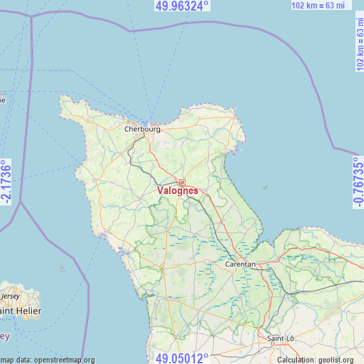
Valognes GPS coordinates[2]
49° 30' 31.716" North, 1° 28' 13.692" West
| Map corner | latitude | longitude |
|---|---|---|
| Upper-left | 49.96324°, | -2.1736° |
| Center: | 49.50881°, | -1.47047° |
| Lower-right: | 49.05012°, | -0.76735° |
| Map W x H: | 101.5×101.5 km | = 63.1×63.1mi |
| max Lat: | 51.07786° ⇑10.6% North |
| Valognes: | 49.50881° |
| min Lat: | ⇓89.4% South 41.3874° |
| min Long | Valognes | max Long |
| -5.08615° | -1.47047° | 9.52242° |
| W 7.9%⇐ | ⇒92.1% E |
Elevation
Elevation of Valognes is 33 m = 108 ft, and this is 160.7 m = 527 ft below average elevation for this country.
| Max E: |
2333 m = 7654 ft | 88.6% |
| Avg. | 193.7 m = 635 ft | |
| Valognes | 33 m = 108 ft | |
Min E: |
-1 m = -3 ft | 11.4% |
See also: France elevation on elevation.city.
Geographical zone
Valognes is located in North temperate zone (between Tropic of Cancer and the Arctic Circle). Distance of this North polar circle is 1896.3 km =1178.3 mi to North.| Distance of | km | miles | from Valognes |
|---|---|---|---|
| North Pole | 4502.2 | 2797.5 | to North |
| Arctic Circle | 1896.3 | 1178.3 | to North |
| Tropic Cancer | 2898.9 | 1801.3 | to South |
| Equator | 5504.9 | 3420.6 | to South |


Nearby cities:
15 places around Valognes: (largest is in red/bold)
• Bricquebec
12.5 km =7.8 mi,  249°
249°
• Brix
8.9 km =5.5 mi,  297°
297°
• Digosville
14.2 km =8.8 mi,  343°
343°
• La Glacerie
13.4 km =8.3 mi,  323°
323°
• Le Mesnil-au-Val
11.5 km =7.1 mi, 339°
• Le Theil
11.2 km =7 mi,  0°
0°
• Montebourg
6.9 km =4.3 mi,  109°
109°
• Négreville
5.8 km =3.6 mi, 253°
• Rocheville
9 km =5.6 mi,  266°
266°
• Saint-Joseph
5.2 km =3.2 mi, 302°
• Saussemesnil
7.2 km =4.5 mi, 4°
• Sottevast
8.9 km =5.5 mi,  280°
280°
• Tamerville
2.9 km =1.8 mi,  25°
25°
• Teurthéville-Bocage
10.7 km =6.6 mi, 29°
• Tollevast
13.5 km =8.4 mi, 302°
Sources, notices
• [Note1] Compared only with cities in France existing in our database
• [Src1] Map data: © OpenStreetMap contributors (CC-BY-SA)
• [Src2] Other city data from geonames.org with taken over terms of usage.
• [Src3] Geographical zone / Annual Mean Temperature by Robert A. Rohde @ Wikipedia
