Saint-Jean-Trolimon geodata
Saint-Jean-Trolimon (Brittany) is a populated place; located in France in Europe/Paris (GMT+2) time zone. With population of 893 people, there are 9714 cities with bigger population in this country. Compared to other cities in France, 56.9% of cities are located further ↓South; 99.5% of cities are located further →East and 93.6% of cities have higher elevation than Saint-Jean-Trolimon. Note1
Administrative division(s):
- Level 1: Brittany
- Level 2: Département du Finistère
- Level 3: Arrondissement de Quimper
- Level 4: Saint-Jean-Trolimon


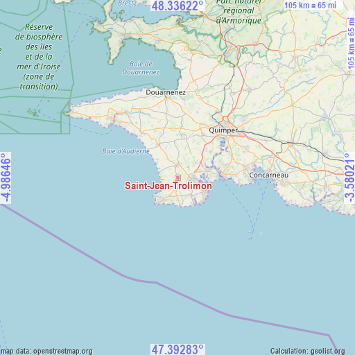
Saint-Jean-Trolimon GPS coordinates[2]
47° 52' 0.012" North, 4° 16' 59.988" West
| Map corner | latitude | longitude |
|---|---|---|
| Upper-left | 48.33622°, | -4.98646° |
| Center: | 47.86667°, | -4.28333° |
| Lower-right: | 47.39283°, | -3.58021° |
| Map W x H: | 104.9×104.9 km | = 65.2×65.2mi |
| max Lat: | 51.07786° ⇑43.1% North |
| Saint-Jean-Trolimon: | 47.86667° |
| min Lat: | ⇓56.9% South 41.3874° |
| min Long | Saint-Jean-Trol | max Long |
| -5.08615° | -4.28333° | 9.52242° |
| W 0.5%⇐ | ⇒99.5% E |
Elevation
Elevation of Saint-Jean-Trolimon is 21 m = 69 ft, and this is 172.7 m = 567 ft below average elevation for this country.
| Max E: |
2333 m = 7654 ft | 93.6% |
| Avg. | 193.7 m = 635 ft | |
| Saint-Jean-Trolimon | 21 m = 69 ft | |
Min E: |
-1 m = -3 ft | 6.4% |
See also: France elevation on elevation.city.
Geographical zone
Saint-Jean-Trolimon is located in North temperate zone (between Tropic of Cancer and the Arctic Circle). Distance of this North polar circle is 2078.9 km =1291.8 mi to North.| Distance of | km | miles | from Saint-Jean-Trolimon |
|---|---|---|---|
| North Pole | 4684.8 | 2911 | to North |
| Arctic Circle | 2078.9 | 1291.8 | to North |
| Tropic Cancer | 2716.4 | 1687.9 | to South |
| Equator | 5322.3 | 3307.1 | to South |


Nearby cities:
15 places around Saint-Jean-Trolimon: (largest is in red/bold)
• Combrit
9.6 km =6 mi,  76°
76°
• Guilvinec
7.6 km =4.7 mi,  178°
178°
• Loctudy
9.5 km =5.9 mi,  113°
113°
• Peumerit
8.3 km =5.2 mi,  346°
346°
• Plobannalec-Lesconil
7.5 km =4.7 mi,  138°
138°
• Plogastel-Saint-Germain
13 km =8.1 mi,  5°
5°
• Plomelin
12.4 km =7.7 mi,  53°
53°
• Plomeur
3.7 km =2.3 mi, 180°
• Plonéour-Lanvern
3.7 km =2.3 mi,  0°
0°
• Plovan
8.3 km =5.2 mi,  311°
311°
• Pont-l’Abbé
5 km =3.1 mi,  90°
90°
• Pouldreuzic
11.2 km =7 mi,  326°
326°
• Treffiagat
5.7 km =3.5 mi,  167°
167°
• Tréméoc
6.2 km =3.9 mi, 53°
• Île-Tudy
9.5 km =5.9 mi, 113°
Sources, notices
• [Note1] Compared only with cities in France existing in our database
• [Src1] Map data: © OpenStreetMap contributors (CC-BY-SA)
• [Src2] Other city data from geonames.org with taken over terms of usage.
• [Src3] Geographical zone / Annual Mean Temperature by Robert A. Rohde @ Wikipedia
