Plomelin geodata
Plomelin (Brittany) is a populated place; located in France in Europe/Paris (GMT+2) time zone. With population of 4,318 people, there are 2284 cities with bigger population in this country. Compared to other cities in France, 58.1% of cities are located further ↓South; 99.2% of cities are located further →East and 83.8% of cities have higher elevation than Plomelin. Note1
Administrative division(s):
- Level 1: Brittany
- Level 2: Département du Finistère
- Level 3: Arrondissement de Quimper
- Level 4: Plomelin


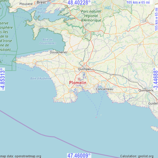
Plomelin GPS coordinates[2]
47° 55' 59.988" North, 4° 9' 0" West
| Map corner | latitude | longitude |
|---|---|---|
| Upper-left | 48.40228°, | -4.85313° |
| Center: | 47.93333°, | -4.15° |
| Lower-right: | 47.46009°, | -3.44688° |
| Map W x H: | 104.8×104.8 km | = 65.1×65.1mi |
| max Lat: | 51.07786° ⇑41.9% North |
| Plomelin: | 47.93333° |
| min Lat: | ⇓58.1% South 41.3874° |
| min Long | Plomelin | max Long |
| -5.08615° | -4.15° | 9.52242° |
| W 0.8%⇐ | ⇒99.2% E |
Elevation
Elevation of Plomelin is 45 m = 148 ft, and this is 148.7 m = 488 ft below average elevation for this country.
| Max E: |
2333 m = 7654 ft | 83.8% |
| Avg. | 193.7 m = 635 ft | |
| Plomelin | 45 m = 148 ft | |
Min E: |
-1 m = -3 ft | 16.2% |
See also: France elevation on elevation.city.
Geographical zone
Plomelin is located in North temperate zone (between Tropic of Cancer and the Arctic Circle). Distance of this North polar circle is 2071.5 km =1287.2 mi to North.| Distance of | km | miles | from Plomelin |
|---|---|---|---|
| North Pole | 4677.4 | 2906.4 | to North |
| Arctic Circle | 2071.5 | 1287.2 | to North |
| Tropic Cancer | 2723.8 | 1692.5 | to South |
| Equator | 5329.7 | 3311.7 | to South |


Nearby cities:
15 places around Plomelin: (largest is in red/bold)
• Bénodet
7.2 km =4.5 mi,  152°
152°
• Clohars-Fouesnant
7.6 km =4.7 mi,  122°
122°
• Combrit
5.1 km =3.2 mi,  186°
186°
• Fouesnant
11.1 km =6.9 mi,  114°
114°
• Gouesnach
3.7 km =2.3 mi,  133°
133°
• Loctudy
11.2 km =7 mi, 186°
• Pleuven
9.5 km =5.9 mi, 113°
• Plogastel-Saint-Germain
10.3 km =6.4 mi,  302°
302°
• Plonéis
10.5 km =6.5 mi,  331°
331°
• Plonéour-Lanvern
10.6 km =6.6 mi,  249°
249°
• Pluguffan
6.1 km =3.8 mi,  335°
335°
• Pont-l’Abbé
8.9 km =5.5 mi,  213°
213°
• Quimper
8.3 km =5.2 mi,  26°
26°
• Saint-Évarzec
9.9 km =6.2 mi,  90°
90°
• Tréméoc
6.2 km =3.9 mi,  233°
233°
Sources, notices
• [Note1] Compared only with cities in France existing in our database
• [Src1] Map data: © OpenStreetMap contributors (CC-BY-SA)
• [Src2] Other city data from geonames.org with taken over terms of usage.
• [Src3] Geographical zone / Annual Mean Temperature by Robert A. Rohde @ Wikipedia
