Saint-Jean-de-Daye geodata
Saint-Jean-de-Daye (Normandy) is a populated place; located in France in Europe/Paris (GMT+2) time zone. With population of 632 people, there are 12784 cities with bigger population in this country. Compared to other cities in France, 84.8% of cities are located further ↓South; 89.5% of cities are located further →East and 84.1% of cities have higher elevation than Saint-Jean-de-Daye. Note1
Administrative division(s):
- Level 1: Normandy
- Level 2: Manche
- Level 3: Arrondissement de Saint-Lô
- Level 4: Saint-Jean-de-Daye


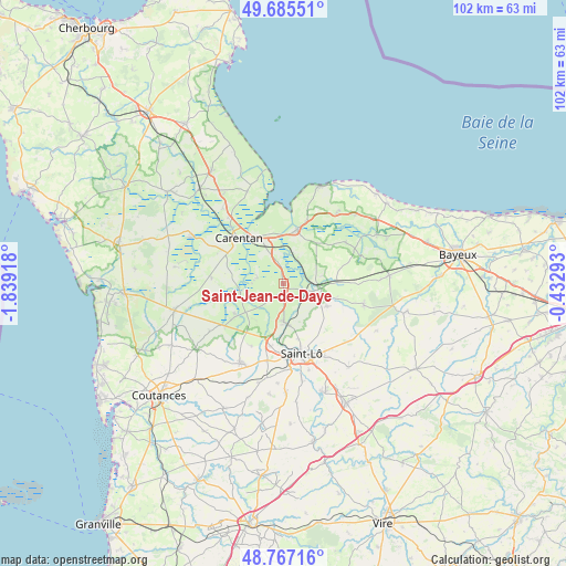
Saint-Jean-de-Daye GPS coordinates[2]
49° 13' 42.492" North, 1° 8' 9.78" West
| Map corner | latitude | longitude |
|---|---|---|
| Upper-left | 49.68551°, | -1.83918° |
| Center: | 49.22847°, | -1.13605° |
| Lower-right: | 48.76716°, | -0.43293° |
| Map W x H: | 102.1×102.1 km | = 63.4×63.4mi |
| max Lat: | 51.07786° ⇑15.2% North |
| Saint-Jean-de-Daye: | 49.22847° |
| min Lat: | ⇓84.8% South 41.3874° |
| min Long | Saint-Jean-de-D | max Long |
| -5.08615° | -1.13605° | 9.52242° |
| W 10.5%⇐ | ⇒89.5% E |
Elevation
Elevation of Saint-Jean-de-Daye is 44 m = 144 ft, and this is 149.7 m = 491 ft below average elevation for this country.
| Max E: |
2333 m = 7654 ft | 84.1% |
| Avg. | 193.7 m = 635 ft | |
| Saint-Jean-de-Daye | 44 m = 144 ft | |
Min E: |
-1 m = -3 ft | 15.9% |
See also: France elevation on elevation.city.
Geographical zone
Saint-Jean-de-Daye is located in North temperate zone (between Tropic of Cancer and the Arctic Circle). Distance of this North polar circle is 1927.5 km =1197.7 mi to North.| Distance of | km | miles | from Saint-Jean-de-Daye |
|---|---|---|---|
| North Pole | 4533.4 | 2816.9 | to North |
| Arctic Circle | 1927.5 | 1197.7 | to North |
| Tropic Cancer | 2867.8 | 1782 | to South |
| Equator | 5473.7 | 3401.2 | to South |


Nearby cities:
15 places around Saint-Jean-de-Daye: (largest is in red/bold)
• Carentan
11.6 km =7.2 mi,  315°
315°
• Graignes-Mesnil-Angot
5.2 km =3.2 mi,  297°
297°
• Hébécrevon
11.5 km =7.1 mi,  191°
191°
• Isigny-sur-Mer
10 km =6.2 mi,  13°
13°
• La Meauffe
6.1 km =3.8 mi,  162°
162°
• Le Dézert
3.4 km =2.1 mi,  217°
217°
• Montmartin-en-Graignes
5.2 km =3.2 mi,  350°
350°
• Moon-sur-Elle
6.8 km =4.2 mi,  110°
110°
• Pont-Hébert
6.8 km =4.2 mi,  178°
178°
• Remilly-sur-Lozon
10.3 km =6.4 mi,  238°
238°
• Saint-Clair-sur-l'Elle
8.7 km =5.4 mi,  117°
117°
• Saint-Fromond
3.5 km =2.2 mi,  104°
104°
• Saint-Georges-Montcocq
11.6 km =7.2 mi, 164°
• Saint-Hilaire-Petitville
10.2 km =6.3 mi, 323°
• Tribehou
8 km =5 mi,  257°
257°
Sources, notices
• [Note1] Compared only with cities in France existing in our database
• [Src1] Map data: © OpenStreetMap contributors (CC-BY-SA)
• [Src2] Other city data from geonames.org with taken over terms of usage.
• [Src3] Geographical zone / Annual Mean Temperature by Robert A. Rohde @ Wikipedia
