Pont-Hébert geodata
Pont-Hébert (Normandy) is a populated place; located in France in Europe/Paris (GMT+2) time zone. With population of 1,769 people, there are 5361 cities with bigger population in this country. Compared to other cities in France, 83.6% of cities are located further ↓South; 89.5% of cities are located further →East and 83.4% of cities have higher elevation than Pont-Hébert. Note1
Administrative division(s):
- Level 1: Normandy
- Level 2: Manche
- Level 3: Arrondissement de Saint-Lô
- Level 4: Pont-Hébert


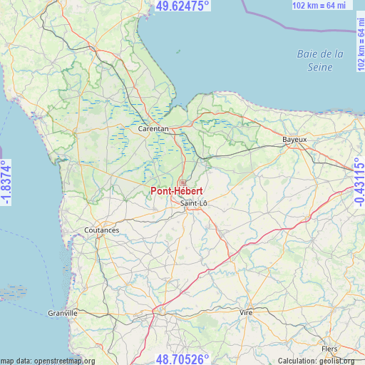
Pont-Hébert GPS coordinates[2]
49° 10' 1.704" North, 1° 8' 3.408" West
| Map corner | latitude | longitude |
|---|---|---|
| Upper-left | 49.62475°, | -1.8374° |
| Center: | 49.16714°, | -1.13428° |
| Lower-right: | 48.70526°, | -0.43115° |
| Map W x H: | 102.2×102.2 km | = 63.5×63.5mi |
| max Lat: | 51.07786° ⇑16.4% North |
| Pont-Hébert: | 49.16714° |
| min Lat: | ⇓83.6% South 41.3874° |
| min Long | Pont-Hébert | max Long |
| -5.08615° | -1.13428° | 9.52242° |
| W 10.5%⇐ | ⇒89.5% E |
Elevation
Elevation of Pont-Hébert is 46 m = 151 ft, and this is 147.7 m = 485 ft below average elevation for this country.
| Max E: |
2333 m = 7654 ft | 83.4% |
| Avg. | 193.7 m = 635 ft | |
| Pont-Hébert | 46 m = 151 ft | |
Min E: |
-1 m = -3 ft | 16.6% |
See also: France elevation on elevation.city.
Geographical zone
Pont-Hébert is located in North temperate zone (between Tropic of Cancer and the Arctic Circle). Distance of this North polar circle is 1934.3 km =1201.9 mi to North.| Distance of | km | miles | from Pont-Hébert |
|---|---|---|---|
| North Pole | 4540.2 | 2821.1 | to North |
| Arctic Circle | 1934.3 | 1201.9 | to North |
| Tropic Cancer | 2861 | 1777.7 | to South |
| Equator | 5466.9 | 3397 | to South |


Nearby cities:
15 places around Pont-Hébert: (largest is in red/bold)
• Agneaux
5.7 km =3.5 mi,  159°
159°
• Hébécrevon
5 km =3.1 mi,  207°
207°
• La Barre-de-Semilly
9.5 km =5.9 mi,  129°
129°
• La Chapelle-en-Juger
7.3 km =4.5 mi,  233°
233°
• La Meauffe
2 km =1.2 mi,  58°
58°
• Le Dézert
4.7 km =2.9 mi,  331°
331°
• Moon-sur-Elle
7.7 km =4.8 mi,  54°
54°
• Remilly-sur-Lozon
9 km =5.6 mi,  279°
279°
• Saint-Clair-sur-l'Elle
8.2 km =5.1 mi,  69°
69°
• Saint-Fromond
6.8 km =4.2 mi,  28°
28°
• Saint-Georges-Montcocq
5.3 km =3.3 mi,  145°
145°
• Saint-Gilles
7.6 km =4.7 mi,  204°
204°
• Saint-Jean-de-Daye
6.8 km =4.2 mi,  358°
358°
• Saint-Lô
6.5 km =4 mi, 150°
• Tribehou
9.4 km =5.8 mi,  302°
302°
Sources, notices
• [Note1] Compared only with cities in France existing in our database
• [Src1] Map data: © OpenStreetMap contributors (CC-BY-SA)
• [Src2] Other city data from geonames.org with taken over terms of usage.
• [Src3] Geographical zone / Annual Mean Temperature by Robert A. Rohde @ Wikipedia
